You are here: Home > Network List > CN - Canadian National Seismograph Network Stations List
> Station INK INUVIK, NT > Earthquake Result Viewer
INK INUVIK, NT - Earthquake Result Viewer
*The percent match for this event was below the threshold and hence no stack was calculated.
| Earthquake location: |
Near Coast Of Venezuela |
| Earthquake latitude/longitude: |
12.0/-69.6 |
| Earthquake time(UTC): |
2017/03/10 (069) 13:46:39 GMT |
| Earthquake Depth: |
10 km |
| Earthquake Magnitude: |
5.5 mb |
| Earthquake Catalog/Contributor: |
NEIC PDE/us |
|
| Network: |
CN Canadian National Seismograph Network |
| Station: |
INK INUVIK, NT |
| Lat/Lon: |
68.31 N/133.53 W |
| Elevation: |
44 m |
|
| Distance: |
69.5 deg |
| Az: |
339.104 deg |
| Baz: |
110.153 deg |
| Ray Param: |
$rayparam |
*The percent match for this event was below the threshold and hence was not used in the summary stack. |
|
| Radial Match: |
54.386158 % |
| Radial Bump: |
400 |
| Transverse Match: |
54.5816 % |
| Transverse Bump: |
400 |
| SOD ConfigId: |
11737051 |
| Insert Time: |
2019-04-26 22:05:11.675 +0000 |
| GWidth: |
2.5 |
| Max Bumps: |
400 |
| Tol: |
0.001 |
|
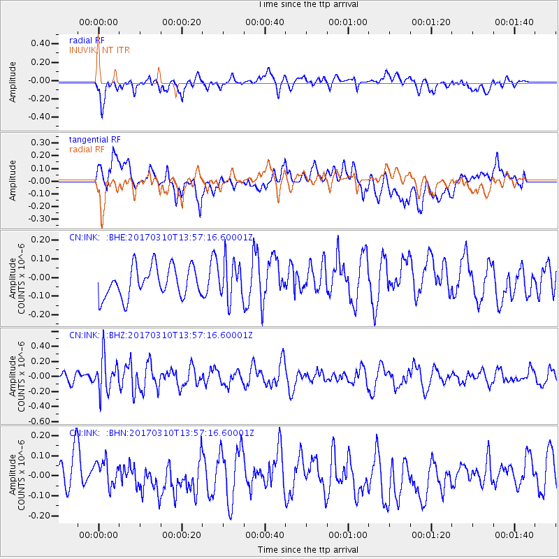
Signal To Noise
| Channel | StoN | STA | LTA |
| CN:INK: :BHZ:20170310T13:57:16.60001Z | 2.4324293 | 2.3437009E-7 | 9.6352274E-8 |
| CN:INK: :BHN:20170310T13:57:16.60001Z | 0.74762505 | 8.5279225E-8 | 1.14066836E-7 |
| CN:INK: :BHE:20170310T13:57:16.60001Z | 1.2935933 | 1.0524657E-7 | 8.135986E-8 |
| Arrivals |
| Ps | |
| PpPs | |
| PsPs/PpSs | |


