You are here: Home > Network List > TA - USArray Transportable Network (new EarthScope stations) Stations List
> Station 435B Jarrell, TX, USA > Earthquake Result Viewer
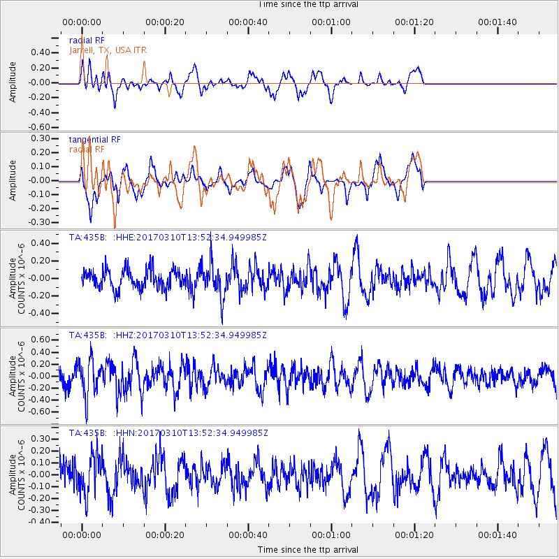
435B Jarrell, TX, USA - Earthquake Result Viewer
*The percent match for this event was below the threshold and hence no stack was calculated.
| Earthquake location: |
Near Coast Of Venezuela |
| Earthquake latitude/longitude: |
12.0/-69.6 |
| Earthquake time(UTC): |
2017/03/10 (069) 13:46:39 GMT |
| Earthquake Depth: |
10 km |
| Earthquake Magnitude: |
5.5 mb |
| Earthquake Catalog/Contributor: |
NEIC PDE/us |
|
| Network: |
TA USArray Transportable Network (new EarthScope stations) |
| Station: |
435B Jarrell, TX, USA |
| Lat/Lon: |
30.78 N/97.58 W |
| Elevation: |
248 m |
|
| Distance: |
32.0 deg |
| Az: |
310.243 deg |
| Baz: |
119.78 deg |
| Ray Param: |
$rayparam |
*The percent match for this event was below the threshold and hence was not used in the summary stack. |
|
| Radial Match: |
65.62719 % |
| Radial Bump: |
378 |
| Transverse Match: |
50.327423 % |
| Transverse Bump: |
297 |
| SOD ConfigId: |
11737051 |
| Insert Time: |
2019-04-26 22:08:54.032 +0000 |
| GWidth: |
2.5 |
| Max Bumps: |
400 |
| Tol: |
0.001 |
|
Signal To Noise
| Channel | StoN | STA | LTA |
| TA:435B: :HHZ:20170310T13:52:34.949985Z | 2.8956525 | 3.1279666E-7 | 1.0802285E-7 |
| TA:435B: :HHN:20170310T13:52:34.949985Z | 1.5139736 | 1.6963374E-7 | 1.1204537E-7 |
| TA:435B: :HHE:20170310T13:52:34.949985Z | 1.8946341 | 1.9965066E-7 | 1.053769E-7 |
| Arrivals |
| Ps | |
| PpPs | |
| PsPs/PpSs | |


