You are here: Home > Network List > AV - Alaska Volcano Observatory Stations List
> Station SPCR Ckakachatna River, Mount Spurr, Alaska > Earthquake Result Viewer
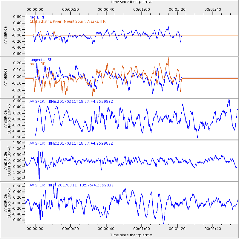
SPCR Ckakachatna River, Mount Spurr, Alaska - Earthquake Result Viewer
*The percent match for this event was below the threshold and hence no stack was calculated.
| Earthquake location: |
Kyushu, Japan |
| Earthquake latitude/longitude: |
31.0/130.4 |
| Earthquake time(UTC): |
2017/03/11 (070) 18:48:41 GMT |
| Earthquake Depth: |
139 km |
| Earthquake Magnitude: |
5.3 Mww |
| Earthquake Catalog/Contributor: |
NEIC PDE/us |
|
| Network: |
AV Alaska Volcano Observatory |
| Station: |
SPCR Ckakachatna River, Mount Spurr, Alaska |
| Lat/Lon: |
61.20 N/152.21 W |
| Elevation: |
984 m |
|
| Distance: |
57.4 deg |
| Az: |
34.13 deg |
| Baz: |
275.735 deg |
| Ray Param: |
$rayparam |
*The percent match for this event was below the threshold and hence was not used in the summary stack. |
|
| Radial Match: |
42.09976 % |
| Radial Bump: |
400 |
| Transverse Match: |
43.068424 % |
| Transverse Bump: |
299 |
| SOD ConfigId: |
11737051 |
| Insert Time: |
2019-04-26 22:21:02.373 +0000 |
| GWidth: |
2.5 |
| Max Bumps: |
400 |
| Tol: |
0.001 |
|
Signal To Noise
| Channel | StoN | STA | LTA |
| AV:SPCR: :BHZ:20170311T18:57:44.259983Z | 2.8000505 | 5.7028495E-7 | 2.0366953E-7 |
| AV:SPCR: :BHN:20170311T18:57:44.259983Z | 1.0048877 | 2.3474543E-7 | 2.3360366E-7 |
| AV:SPCR: :BHE:20170311T18:57:44.259983Z | 1.243541 | 2.942844E-7 | 2.3665035E-7 |
| Arrivals |
| Ps | |
| PpPs | |
| PsPs/PpSs | |


