You are here: Home > Network List > CI - Caltech Regional Seismic Network Stations List
> Station TIN Tinemaha, Big Pine, CA, USA > Earthquake Result Viewer
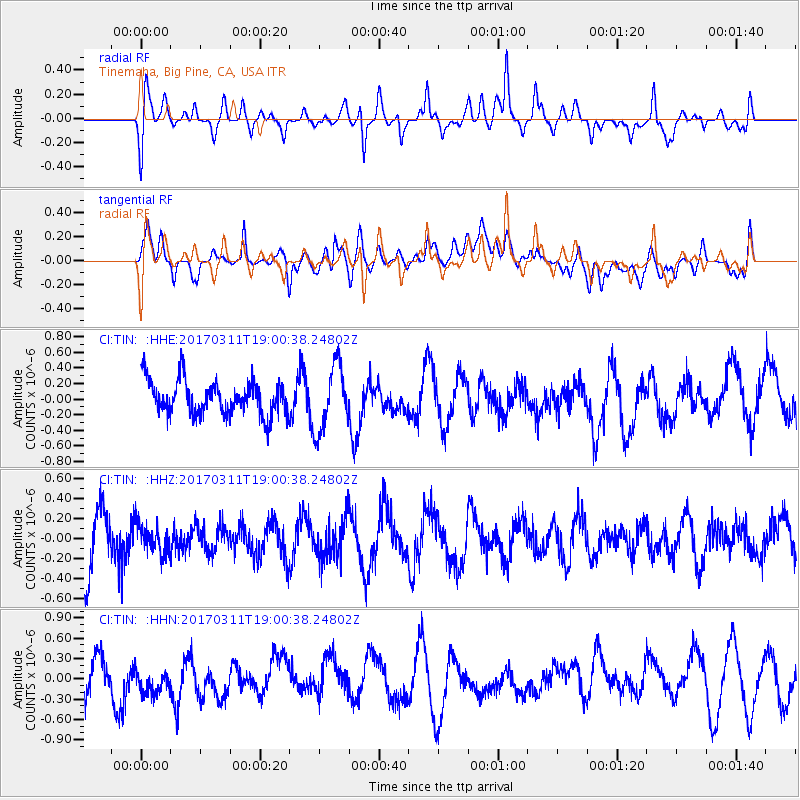
TIN Tinemaha, Big Pine, CA, USA - Earthquake Result Viewer
*The percent match for this event was below the threshold and hence no stack was calculated.
| Earthquake location: |
Kyushu, Japan |
| Earthquake latitude/longitude: |
31.0/130.4 |
| Earthquake time(UTC): |
2017/03/11 (070) 18:48:41 GMT |
| Earthquake Depth: |
139 km |
| Earthquake Magnitude: |
5.3 Mww |
| Earthquake Catalog/Contributor: |
NEIC PDE/us |
|
| Network: |
CI Caltech Regional Seismic Network |
| Station: |
TIN Tinemaha, Big Pine, CA, USA |
| Lat/Lon: |
37.05 N/118.23 W |
| Elevation: |
1197 m |
|
| Distance: |
86.7 deg |
| Az: |
48.262 deg |
| Baz: |
306.776 deg |
| Ray Param: |
$rayparam |
*The percent match for this event was below the threshold and hence was not used in the summary stack. |
|
| Radial Match: |
55.254826 % |
| Radial Bump: |
400 |
| Transverse Match: |
53.403343 % |
| Transverse Bump: |
400 |
| SOD ConfigId: |
11737051 |
| Insert Time: |
2019-04-26 22:21:54.897 +0000 |
| GWidth: |
2.5 |
| Max Bumps: |
400 |
| Tol: |
0.001 |
|
Signal To Noise
| Channel | StoN | STA | LTA |
| CI:TIN: :HHZ:20170311T19:00:38.24802Z | 0.47138155 | 1.3623014E-7 | 2.8900186E-7 |
| CI:TIN: :HHN:20170311T19:00:38.24802Z | 0.7672236 | 2.3283188E-7 | 3.034733E-7 |
| CI:TIN: :HHE:20170311T19:00:38.24802Z | 1.942945 | 4.2014014E-7 | 2.1623882E-7 |
| Arrivals |
| Ps | |
| PpPs | |
| PsPs/PpSs | |


