You are here: Home > Network List > TA - USArray Transportable Network (new EarthScope stations) Stations List
> Station 121A Cookes Peak, Deming, NM, USA > Earthquake Result Viewer
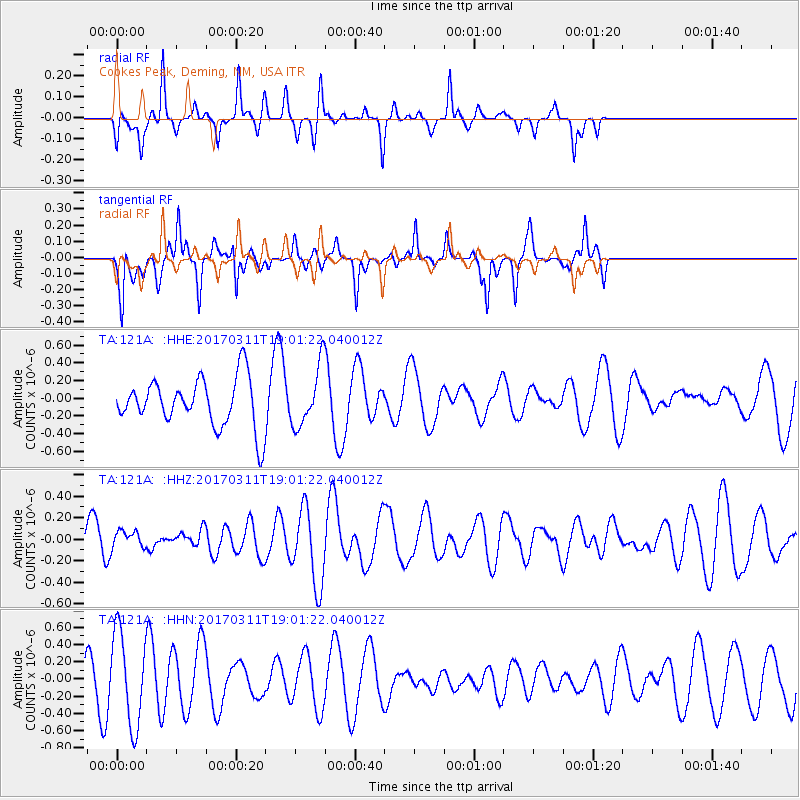
121A Cookes Peak, Deming, NM, USA - Earthquake Result Viewer
*The percent match for this event was below the threshold and hence no stack was calculated.
| Earthquake location: |
Kyushu, Japan |
| Earthquake latitude/longitude: |
31.0/130.4 |
| Earthquake time(UTC): |
2017/03/11 (070) 18:48:41 GMT |
| Earthquake Depth: |
139 km |
| Earthquake Magnitude: |
5.3 Mww |
| Earthquake Catalog/Contributor: |
NEIC PDE/us |
|
| Network: |
TA USArray Transportable Network (new EarthScope stations) |
| Station: |
121A Cookes Peak, Deming, NM, USA |
| Lat/Lon: |
32.53 N/107.79 W |
| Elevation: |
1652 m |
|
| Distance: |
96.2 deg |
| Az: |
46.221 deg |
| Baz: |
312.778 deg |
| Ray Param: |
$rayparam |
*The percent match for this event was below the threshold and hence was not used in the summary stack. |
|
| Radial Match: |
14.26761 % |
| Radial Bump: |
168 |
| Transverse Match: |
42.167286 % |
| Transverse Bump: |
263 |
| SOD ConfigId: |
11737051 |
| Insert Time: |
2019-04-26 22:24:56.970 +0000 |
| GWidth: |
2.5 |
| Max Bumps: |
400 |
| Tol: |
0.001 |
|
Signal To Noise
| Channel | StoN | STA | LTA |
| TA:121A: :HHZ:20170311T19:01:22.040012Z | 0.46240067 | 7.9440184E-8 | 1.7179947E-7 |
| TA:121A: :HHN:20170311T19:01:22.040012Z | 2.5638545 | 5.379428E-7 | 2.0981798E-7 |
| TA:121A: :HHE:20170311T19:01:22.040012Z | 1.1921467 | 3.248781E-7 | 2.7251522E-7 |
| Arrivals |
| Ps | |
| PpPs | |
| PsPs/PpSs | |


