You are here: Home > Network List > TA - USArray Transportable Network (new EarthScope stations) Stations List
> Station R32K Eaglecrest, AK, USA > Earthquake Result Viewer
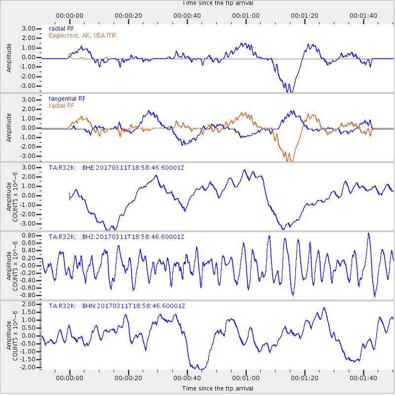
R32K Eaglecrest, AK, USA - Earthquake Result Viewer
*The percent match for this event was below the threshold and hence no stack was calculated.
| Earthquake location: |
Kyushu, Japan |
| Earthquake latitude/longitude: |
31.0/130.4 |
| Earthquake time(UTC): |
2017/03/11 (070) 18:48:41 GMT |
| Earthquake Depth: |
139 km |
| Earthquake Magnitude: |
5.3 Mww |
| Earthquake Catalog/Contributor: |
NEIC PDE/us |
|
| Network: |
TA USArray Transportable Network (new EarthScope stations) |
| Station: |
R32K Eaglecrest, AK, USA |
| Lat/Lon: |
58.27 N/134.52 W |
| Elevation: |
386 m |
|
| Distance: |
66.7 deg |
| Az: |
34.95 deg |
| Baz: |
291.411 deg |
| Ray Param: |
$rayparam |
*The percent match for this event was below the threshold and hence was not used in the summary stack. |
|
| Radial Match: |
18.994543 % |
| Radial Bump: |
400 |
| Transverse Match: |
24.673983 % |
| Transverse Bump: |
400 |
| SOD ConfigId: |
11737051 |
| Insert Time: |
2019-04-26 22:25:23.103 +0000 |
| GWidth: |
2.5 |
| Max Bumps: |
400 |
| Tol: |
0.001 |
|
Signal To Noise
| Channel | StoN | STA | LTA |
| TA:R32K: :BHZ:20170311T18:58:46.60001Z | 1.0342661 | 1.8640289E-7 | 1.8022719E-7 |
| TA:R32K: :BHN:20170311T18:58:46.60001Z | 2.2152784 | 7.3790557E-7 | 3.3309834E-7 |
| TA:R32K: :BHE:20170311T18:58:46.60001Z | 1.7939458 | 2.5699562E-6 | 1.4325718E-6 |
| Arrivals |
| Ps | |
| PpPs | |
| PsPs/PpSs | |


