You are here: Home > Network List > TA - USArray Transportable Network (new EarthScope stations) Stations List
> Station R31K City Hall, Gustavus, AK, USA > Earthquake Result Viewer
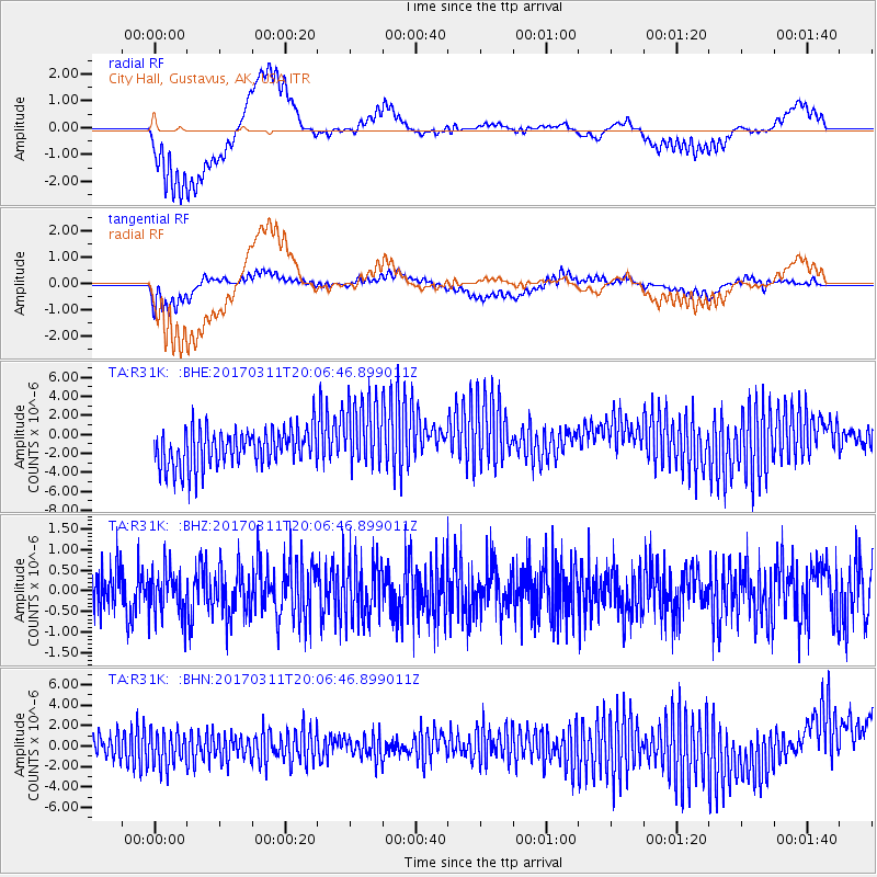
R31K City Hall, Gustavus, AK, USA - Earthquake Result Viewer
*The percent match for this event was below the threshold and hence no stack was calculated.
| Earthquake location: |
Near East Coast Of Honshu, Japan |
| Earthquake latitude/longitude: |
37.5/141.5 |
| Earthquake time(UTC): |
2017/03/11 (070) 19:57:48 GMT |
| Earthquake Depth: |
44 km |
| Earthquake Magnitude: |
5.3 Mww |
| Earthquake Catalog/Contributor: |
NEIC PDE/us |
|
| Network: |
TA USArray Transportable Network (new EarthScope stations) |
| Station: |
R31K City Hall, Gustavus, AK, USA |
| Lat/Lon: |
58.41 N/135.74 W |
| Elevation: |
15 m |
|
| Distance: |
55.3 deg |
| Az: |
39.399 deg |
| Baz: |
286.521 deg |
| Ray Param: |
$rayparam |
*The percent match for this event was below the threshold and hence was not used in the summary stack. |
|
| Radial Match: |
44.868896 % |
| Radial Bump: |
400 |
| Transverse Match: |
36.95689 % |
| Transverse Bump: |
400 |
| SOD ConfigId: |
11737051 |
| Insert Time: |
2019-04-26 22:34:15.699 +0000 |
| GWidth: |
2.5 |
| Max Bumps: |
400 |
| Tol: |
0.001 |
|
Signal To Noise
| Channel | StoN | STA | LTA |
| TA:R31K: :BHZ:20170311T20:06:46.899011Z | 0.8727635 | 5.5727213E-7 | 6.3851445E-7 |
| TA:R31K: :BHN:20170311T20:06:46.899011Z | 1.1112396 | 1.8531408E-6 | 1.667634E-6 |
| TA:R31K: :BHE:20170311T20:06:46.899011Z | 1.8488216 | 3.672751E-6 | 1.986536E-6 |
| Arrivals |
| Ps | |
| PpPs | |
| PsPs/PpSs | |


