You are here: Home > Network List > TA - USArray Transportable Network (new EarthScope stations) Stations List
> Station D25K Kavik River, AK, USA > Earthquake Result Viewer
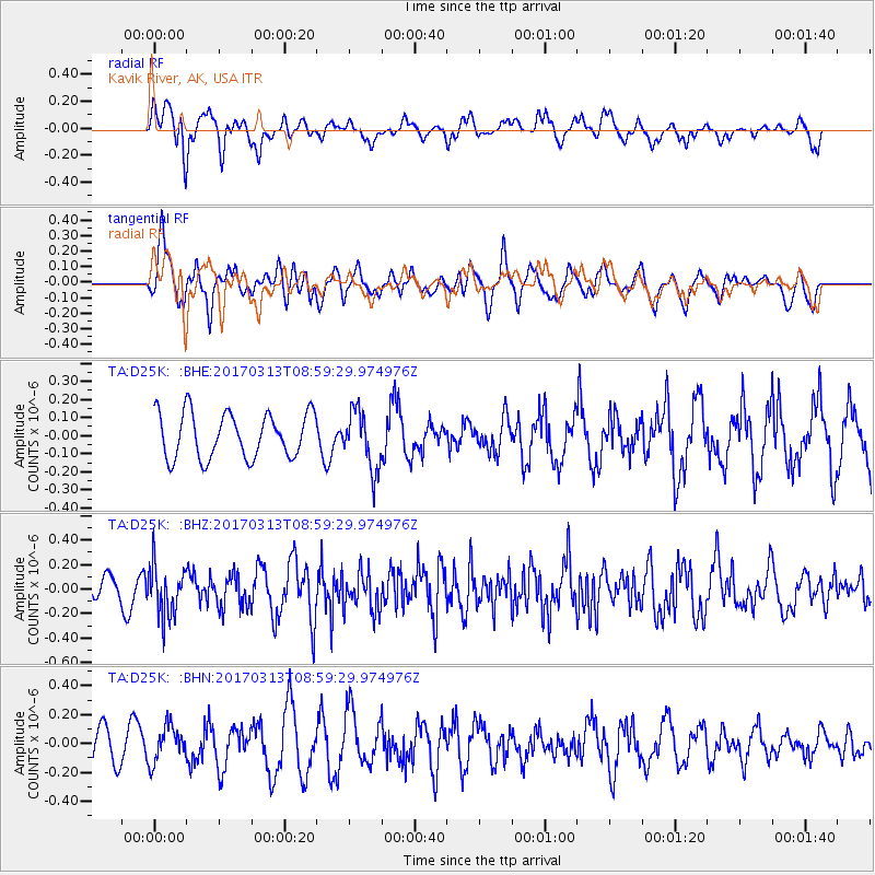
D25K Kavik River, AK, USA - Earthquake Result Viewer
*The percent match for this event was below the threshold and hence no stack was calculated.
| Earthquake location: |
Mariana Islands |
| Earthquake latitude/longitude: |
14.3/145.3 |
| Earthquake time(UTC): |
2017/03/13 (072) 08:49:06 GMT |
| Earthquake Depth: |
101 km |
| Earthquake Magnitude: |
5.5 Mi |
| Earthquake Catalog/Contributor: |
NEIC PDE/pt |
|
| Network: |
TA USArray Transportable Network (new EarthScope stations) |
| Station: |
D25K Kavik River, AK, USA |
| Lat/Lon: |
69.32 N/146.38 W |
| Elevation: |
770 m |
|
| Distance: |
69.1 deg |
| Az: |
20.688 deg |
| Baz: |
254.616 deg |
| Ray Param: |
$rayparam |
*The percent match for this event was below the threshold and hence was not used in the summary stack. |
|
| Radial Match: |
70.70932 % |
| Radial Bump: |
400 |
| Transverse Match: |
65.25672 % |
| Transverse Bump: |
400 |
| SOD ConfigId: |
11737051 |
| Insert Time: |
2019-04-26 22:41:22.274 +0000 |
| GWidth: |
2.5 |
| Max Bumps: |
400 |
| Tol: |
0.001 |
|
Signal To Noise
| Channel | StoN | STA | LTA |
| TA:D25K: :BHZ:20170313T08:59:29.974976Z | 2.7087083 | 2.0044243E-7 | 7.399927E-8 |
| TA:D25K: :BHN:20170313T08:59:29.974976Z | 0.81811464 | 1.2332755E-7 | 1.5074605E-7 |
| TA:D25K: :BHE:20170313T08:59:29.974976Z | 1.3286376 | 1.6364262E-7 | 1.2316573E-7 |
| Arrivals |
| Ps | |
| PpPs | |
| PsPs/PpSs | |


