You are here: Home > Network List > TA - USArray Transportable Network (new EarthScope stations) Stations List
> Station F21K Alatna River, AK, USA > Earthquake Result Viewer
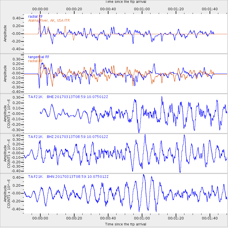
F21K Alatna River, AK, USA - Earthquake Result Viewer
*The percent match for this event was below the threshold and hence no stack was calculated.
| Earthquake location: |
Mariana Islands |
| Earthquake latitude/longitude: |
14.3/145.3 |
| Earthquake time(UTC): |
2017/03/13 (072) 08:49:06 GMT |
| Earthquake Depth: |
101 km |
| Earthquake Magnitude: |
5.5 Mi |
| Earthquake Catalog/Contributor: |
NEIC PDE/pt |
|
| Network: |
TA USArray Transportable Network (new EarthScope stations) |
| Station: |
F21K Alatna River, AK, USA |
| Lat/Lon: |
67.22 N/153.48 W |
| Elevation: |
597 m |
|
| Distance: |
65.9 deg |
| Az: |
21.945 deg |
| Baz: |
248.498 deg |
| Ray Param: |
$rayparam |
*The percent match for this event was below the threshold and hence was not used in the summary stack. |
|
| Radial Match: |
48.18651 % |
| Radial Bump: |
400 |
| Transverse Match: |
56.29348 % |
| Transverse Bump: |
400 |
| SOD ConfigId: |
11737051 |
| Insert Time: |
2019-04-26 22:41:24.066 +0000 |
| GWidth: |
2.5 |
| Max Bumps: |
400 |
| Tol: |
0.001 |
|
Signal To Noise
| Channel | StoN | STA | LTA |
| TA:F21K: :BHZ:20170313T08:59:10.075012Z | 1.4373093 | 1.4597586E-7 | 1.0156191E-7 |
| TA:F21K: :BHN:20170313T08:59:10.075012Z | 1.5956804 | 1.6730648E-7 | 1.04849626E-7 |
| TA:F21K: :BHE:20170313T08:59:10.075012Z | 1.4998987 | 9.120338E-8 | 6.080636E-8 |
| Arrivals |
| Ps | |
| PpPs | |
| PsPs/PpSs | |


