You are here: Home > Network List > TA - USArray Transportable Network (new EarthScope stations) Stations List
> Station J26L Joseph Creek, AK, USA > Earthquake Result Viewer
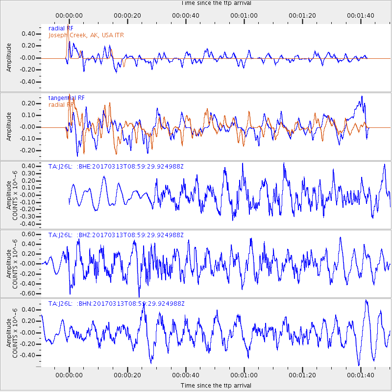
J26L Joseph Creek, AK, USA - Earthquake Result Viewer
*The percent match for this event was below the threshold and hence no stack was calculated.
| Earthquake location: |
Mariana Islands |
| Earthquake latitude/longitude: |
14.3/145.3 |
| Earthquake time(UTC): |
2017/03/13 (072) 08:49:06 GMT |
| Earthquake Depth: |
101 km |
| Earthquake Magnitude: |
5.5 Mi |
| Earthquake Catalog/Contributor: |
NEIC PDE/pt |
|
| Network: |
TA USArray Transportable Network (new EarthScope stations) |
| Station: |
J26L Joseph Creek, AK, USA |
| Lat/Lon: |
64.50 N/143.56 W |
| Elevation: |
1144 m |
|
| Distance: |
69.1 deg |
| Az: |
26.006 deg |
| Baz: |
259.102 deg |
| Ray Param: |
$rayparam |
*The percent match for this event was below the threshold and hence was not used in the summary stack. |
|
| Radial Match: |
53.17445 % |
| Radial Bump: |
400 |
| Transverse Match: |
57.14755 % |
| Transverse Bump: |
400 |
| SOD ConfigId: |
11737051 |
| Insert Time: |
2019-04-26 22:41:28.980 +0000 |
| GWidth: |
2.5 |
| Max Bumps: |
400 |
| Tol: |
0.001 |
|
Signal To Noise
| Channel | StoN | STA | LTA |
| TA:J26L: :BHZ:20170313T08:59:29.924988Z | 4.5795255 | 3.1851823E-7 | 6.955267E-8 |
| TA:J26L: :BHN:20170313T08:59:29.924988Z | 0.60595334 | 7.606834E-8 | 1.2553497E-7 |
| TA:J26L: :BHE:20170313T08:59:29.924988Z | 0.85125756 | 9.319503E-8 | 1.0947924E-7 |
| Arrivals |
| Ps | |
| PpPs | |
| PsPs/PpSs | |


