You are here: Home > Network List > TA - USArray Transportable Network (new EarthScope stations) Stations List
> Station D25K Kavik River, AK, USA > Earthquake Result Viewer
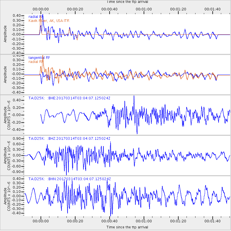
D25K Kavik River, AK, USA - Earthquake Result Viewer
*The percent match for this event was below the threshold and hence no stack was calculated.
| Earthquake location: |
Nicobar Islands, India Region |
| Earthquake latitude/longitude: |
6.1/92.3 |
| Earthquake time(UTC): |
2017/03/14 (073) 02:51:16 GMT |
| Earthquake Depth: |
10 km |
| Earthquake Magnitude: |
6.0 Mww |
| Earthquake Catalog/Contributor: |
NEIC PDE/us |
|
| Network: |
TA USArray Transportable Network (new EarthScope stations) |
| Station: |
D25K Kavik River, AK, USA |
| Lat/Lon: |
69.32 N/146.38 W |
| Elevation: |
770 m |
|
| Distance: |
94.8 deg |
| Az: |
17.732 deg |
| Baz: |
301.504 deg |
| Ray Param: |
$rayparam |
*The percent match for this event was below the threshold and hence was not used in the summary stack. |
|
| Radial Match: |
66.11844 % |
| Radial Bump: |
400 |
| Transverse Match: |
40.701263 % |
| Transverse Bump: |
400 |
| SOD ConfigId: |
11737051 |
| Insert Time: |
2019-04-26 22:47:31.788 +0000 |
| GWidth: |
2.5 |
| Max Bumps: |
400 |
| Tol: |
0.001 |
|
Signal To Noise
| Channel | StoN | STA | LTA |
| TA:D25K: :BHZ:20170314T03:04:07.125024Z | 3.2633483 | 2.4630012E-7 | 7.547466E-8 |
| TA:D25K: :BHN:20170314T03:04:07.125024Z | 1.2248584 | 8.673757E-8 | 7.0814366E-8 |
| TA:D25K: :BHE:20170314T03:04:07.125024Z | 0.6756911 | 6.2430296E-8 | 9.239472E-8 |
| Arrivals |
| Ps | |
| PpPs | |
| PsPs/PpSs | |


