You are here: Home > Network List > TA - USArray Transportable Network (new EarthScope stations) Stations List
> Station F21K Alatna River, AK, USA > Earthquake Result Viewer
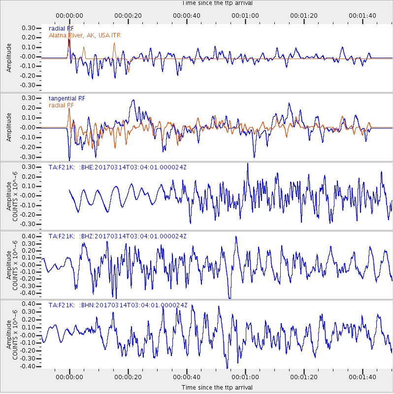
F21K Alatna River, AK, USA - Earthquake Result Viewer
*The percent match for this event was below the threshold and hence no stack was calculated.
| Earthquake location: |
Nicobar Islands, India Region |
| Earthquake latitude/longitude: |
6.1/92.3 |
| Earthquake time(UTC): |
2017/03/14 (073) 02:51:16 GMT |
| Earthquake Depth: |
10 km |
| Earthquake Magnitude: |
6.0 Mww |
| Earthquake Catalog/Contributor: |
NEIC PDE/us |
|
| Network: |
TA USArray Transportable Network (new EarthScope stations) |
| Station: |
F21K Alatna River, AK, USA |
| Lat/Lon: |
67.22 N/153.48 W |
| Elevation: |
597 m |
|
| Distance: |
93.5 deg |
| Az: |
20.844 deg |
| Baz: |
294.678 deg |
| Ray Param: |
$rayparam |
*The percent match for this event was below the threshold and hence was not used in the summary stack. |
|
| Radial Match: |
54.626446 % |
| Radial Bump: |
400 |
| Transverse Match: |
42.323696 % |
| Transverse Bump: |
400 |
| SOD ConfigId: |
11737051 |
| Insert Time: |
2019-04-26 22:47:33.073 +0000 |
| GWidth: |
2.5 |
| Max Bumps: |
400 |
| Tol: |
0.001 |
|
Signal To Noise
| Channel | StoN | STA | LTA |
| TA:F21K: :BHZ:20170314T03:04:01.000024Z | 4.9202986 | 1.8029668E-7 | 3.6643442E-8 |
| TA:F21K: :BHN:20170314T03:04:01.000024Z | 1.0302764 | 1.01194715E-7 | 9.8220944E-8 |
| TA:F21K: :BHE:20170314T03:04:01.000024Z | 0.92227495 | 7.126298E-8 | 7.7268695E-8 |
| Arrivals |
| Ps | |
| PpPs | |
| PsPs/PpSs | |


