You are here: Home > Network List > IC - New China Digital Seismograph Network Stations List
> Station KMI Kunming, Yunnan Province, China > Earthquake Result Viewer
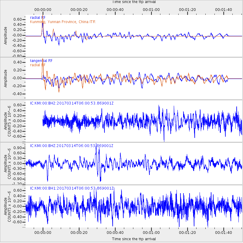
KMI Kunming, Yunnan Province, China - Earthquake Result Viewer
*The percent match for this event was below the threshold and hence no stack was calculated.
| Earthquake location: |
Minahassa Peninsula, Sulawesi |
| Earthquake latitude/longitude: |
0.7/121.2 |
| Earthquake time(UTC): |
2017/03/14 (073) 05:55:21 GMT |
| Earthquake Depth: |
79 km |
| Earthquake Magnitude: |
5.6 mb |
| Earthquake Catalog/Contributor: |
NEIC PDE/us |
|
| Network: |
IC New China Digital Seismograph Network |
| Station: |
KMI Kunming, Yunnan Province, China |
| Lat/Lon: |
25.12 N/102.74 E |
| Elevation: |
1975 m |
|
| Distance: |
30.1 deg |
| Az: |
325.206 deg |
| Baz: |
140.991 deg |
| Ray Param: |
$rayparam |
*The percent match for this event was below the threshold and hence was not used in the summary stack. |
|
| Radial Match: |
68.136284 % |
| Radial Bump: |
400 |
| Transverse Match: |
65.53924 % |
| Transverse Bump: |
400 |
| SOD ConfigId: |
11737051 |
| Insert Time: |
2019-04-26 22:50:36.496 +0000 |
| GWidth: |
2.5 |
| Max Bumps: |
400 |
| Tol: |
0.001 |
|
Signal To Noise
| Channel | StoN | STA | LTA |
| IC:KMI:00:BHZ:20170314T06:00:53.869001Z | 2.5849547 | 3.176826E-7 | 1.2289676E-7 |
| IC:KMI:00:BH1:20170314T06:00:53.869001Z | 1.4534826 | 2.441836E-7 | 1.6799899E-7 |
| IC:KMI:00:BH2:20170314T06:00:53.869001Z | 1.2328324 | 1.7558158E-7 | 1.4242129E-7 |
| Arrivals |
| Ps | |
| PpPs | |
| PsPs/PpSs | |


