You are here: Home > Network List > TA - USArray Transportable Network (new EarthScope stations) Stations List
> Station F21K Alatna River, AK, USA > Earthquake Result Viewer
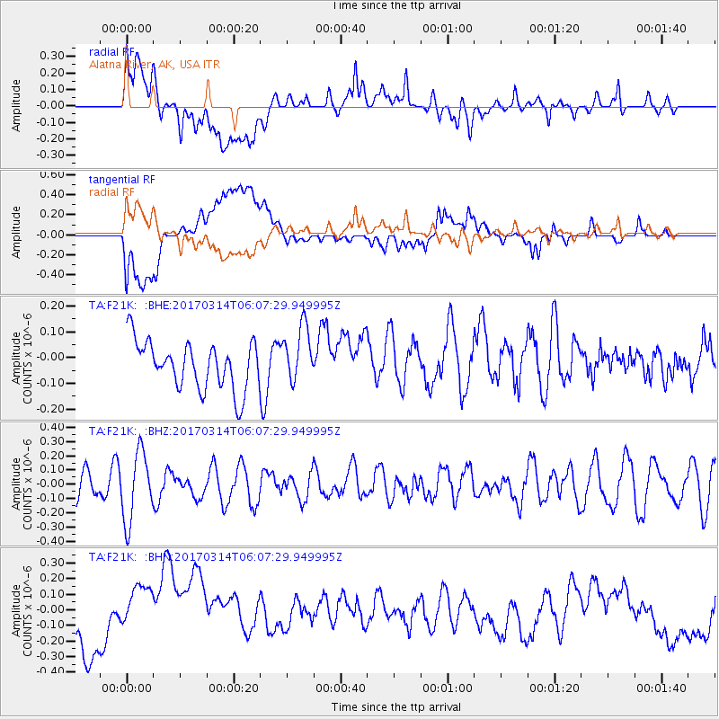
F21K Alatna River, AK, USA - Earthquake Result Viewer
*The percent match for this event was below the threshold and hence no stack was calculated.
| Earthquake location: |
Minahassa Peninsula, Sulawesi |
| Earthquake latitude/longitude: |
0.7/121.2 |
| Earthquake time(UTC): |
2017/03/14 (073) 05:55:21 GMT |
| Earthquake Depth: |
79 km |
| Earthquake Magnitude: |
5.6 mb |
| Earthquake Catalog/Contributor: |
NEIC PDE/us |
|
| Network: |
TA USArray Transportable Network (new EarthScope stations) |
| Station: |
F21K Alatna River, AK, USA |
| Lat/Lon: |
67.22 N/153.48 W |
| Elevation: |
597 m |
|
| Distance: |
87.6 deg |
| Az: |
22.858 deg |
| Baz: |
265.987 deg |
| Ray Param: |
$rayparam |
*The percent match for this event was below the threshold and hence was not used in the summary stack. |
|
| Radial Match: |
41.17833 % |
| Radial Bump: |
400 |
| Transverse Match: |
31.337671 % |
| Transverse Bump: |
400 |
| SOD ConfigId: |
11737051 |
| Insert Time: |
2019-04-26 22:51:38.516 +0000 |
| GWidth: |
2.5 |
| Max Bumps: |
400 |
| Tol: |
0.001 |
|
Signal To Noise
| Channel | StoN | STA | LTA |
| TA:F21K: :BHZ:20170314T06:07:29.949995Z | 2.9148202 | 2.4602954E-7 | 8.440642E-8 |
| TA:F21K: :BHN:20170314T06:07:29.949995Z | 0.9531471 | 1.9944008E-7 | 2.0924375E-7 |
| TA:F21K: :BHE:20170314T06:07:29.949995Z | 1.2125385 | 1.1206328E-7 | 9.242039E-8 |
| Arrivals |
| Ps | |
| PpPs | |
| PsPs/PpSs | |


