You are here: Home > Network List > UW - Pacific Northwest Regional Seismic Network Stations List
> Station UMAT Pilot Rock, OR, USA > Earthquake Result Viewer
UMAT Pilot Rock, OR, USA - Earthquake Result Viewer
*The percent match for this event was below the threshold and hence no stack was calculated.
| Earthquake location: |
Vanuatu Islands |
| Earthquake latitude/longitude: |
-21.0/170.0 |
| Earthquake time(UTC): |
2017/03/14 (073) 12:36:43 GMT |
| Earthquake Depth: |
130 km |
| Earthquake Magnitude: |
5.6 Mww |
| Earthquake Catalog/Contributor: |
NEIC PDE/us |
|
| Network: |
UW Pacific Northwest Regional Seismic Network |
| Station: |
UMAT Pilot Rock, OR, USA |
| Lat/Lon: |
45.29 N/118.96 W |
| Elevation: |
1318 m |
|
| Distance: |
92.2 deg |
| Az: |
41.921 deg |
| Baz: |
242.185 deg |
| Ray Param: |
$rayparam |
*The percent match for this event was below the threshold and hence was not used in the summary stack. |
|
| Radial Match: |
50.888237 % |
| Radial Bump: |
400 |
| Transverse Match: |
60.061047 % |
| Transverse Bump: |
400 |
| SOD ConfigId: |
11737051 |
| Insert Time: |
2019-04-26 22:58:51.597 +0000 |
| GWidth: |
2.5 |
| Max Bumps: |
400 |
| Tol: |
0.001 |
|
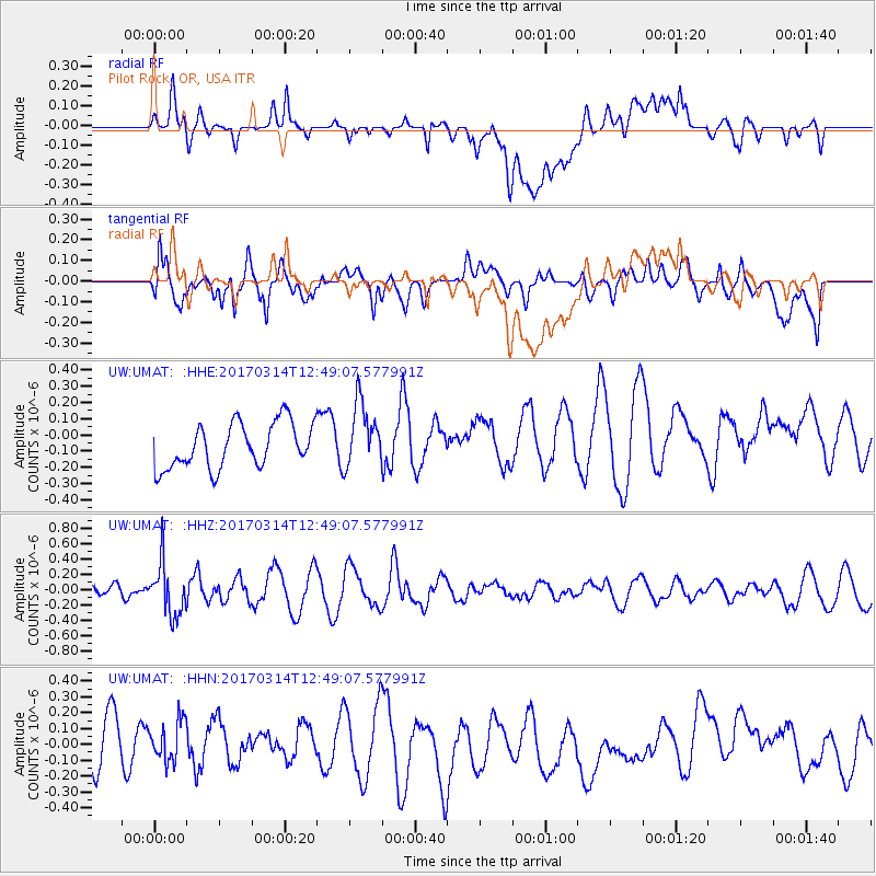
Signal To Noise
| Channel | StoN | STA | LTA |
| UW:UMAT: :HHZ:20170314T12:49:07.577991Z | 3.3414838 | 3.3876756E-7 | 1.0138237E-7 |
| UW:UMAT: :HHN:20170314T12:49:07.577991Z | 0.9661475 | 1.3629631E-7 | 1.4107195E-7 |
| UW:UMAT: :HHE:20170314T12:49:07.577991Z | 1.4450616 | 1.9966855E-7 | 1.3817304E-7 |
| Arrivals |
| Ps | |
| PpPs | |
| PsPs/PpSs | |


