You are here: Home > Network List > TJ - Tajikistan National Seismic Network Stations List
> Station GARM Garm, Tajikistan > Earthquake Result Viewer
GARM Garm, Tajikistan - Earthquake Result Viewer
*The percent match for this event was below the threshold and hence no stack was calculated.
| Earthquake location: |
Off W Coast Of Northern Sumatra |
| Earthquake latitude/longitude: |
3.6/95.9 |
| Earthquake time(UTC): |
2017/03/14 (073) 13:13:38 GMT |
| Earthquake Depth: |
41 km |
| Earthquake Magnitude: |
5.5 mb |
| Earthquake Catalog/Contributor: |
NEIC PDE/us |
|
| Network: |
TJ Tajikistan National Seismic Network |
| Station: |
GARM Garm, Tajikistan |
| Lat/Lon: |
39.00 N/70.32 E |
| Elevation: |
1305 m |
|
| Distance: |
42.2 deg |
| Az: |
329.968 deg |
| Baz: |
140.132 deg |
| Ray Param: |
$rayparam |
*The percent match for this event was below the threshold and hence was not used in the summary stack. |
|
| Radial Match: |
58.945297 % |
| Radial Bump: |
400 |
| Transverse Match: |
55.53466 % |
| Transverse Bump: |
400 |
| SOD ConfigId: |
11737051 |
| Insert Time: |
2019-04-26 23:03:08.068 +0000 |
| GWidth: |
2.5 |
| Max Bumps: |
400 |
| Tol: |
0.001 |
|
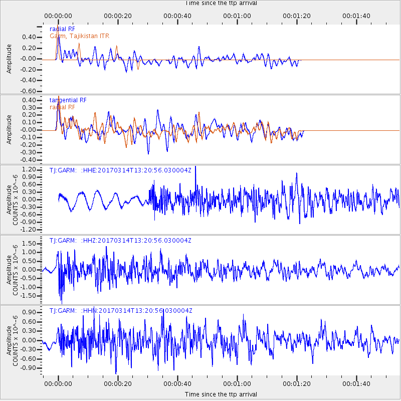
Signal To Noise
| Channel | StoN | STA | LTA |
| TJ:GARM: :HHZ:20170314T13:20:56.030004Z | 4.774524 | 7.094879E-7 | 1.4859866E-7 |
| TJ:GARM: :HHN:20170314T13:20:56.030004Z | 0.94098705 | 2.617145E-7 | 2.7812763E-7 |
| TJ:GARM: :HHE:20170314T13:20:56.030004Z | 1.329962 | 2.991798E-7 | 2.2495364E-7 |
| Arrivals |
| Ps | |
| PpPs | |
| PsPs/PpSs | |


