You are here: Home > Network List > CB - China National Seismic Network Stations List
> Station HEH Heihe,Heilongjiang Province > Earthquake Result Viewer
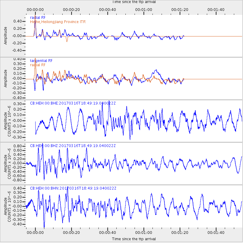
HEH Heihe,Heilongjiang Province - Earthquake Result Viewer
*The percent match for this event was below the threshold and hence no stack was calculated.
| Earthquake location: |
South Of Bali, Indonesia |
| Earthquake latitude/longitude: |
-11.5/114.6 |
| Earthquake time(UTC): |
2017/03/16 (075) 18:39:26 GMT |
| Earthquake Depth: |
10 km |
| Earthquake Magnitude: |
5.5 Mww |
| Earthquake Catalog/Contributor: |
NEIC PDE/us |
|
| Network: |
CB China National Seismic Network |
| Station: |
HEH Heihe,Heilongjiang Province |
| Lat/Lon: |
50.25 N/127.41 E |
| Elevation: |
165 m |
|
| Distance: |
62.5 deg |
| Az: |
9.258 deg |
| Baz: |
194.22 deg |
| Ray Param: |
$rayparam |
*The percent match for this event was below the threshold and hence was not used in the summary stack. |
|
| Radial Match: |
55.218098 % |
| Radial Bump: |
400 |
| Transverse Match: |
62.518734 % |
| Transverse Bump: |
400 |
| SOD ConfigId: |
11737051 |
| Insert Time: |
2019-04-26 23:05:04.785 +0000 |
| GWidth: |
2.5 |
| Max Bumps: |
400 |
| Tol: |
0.001 |
|
Signal To Noise
| Channel | StoN | STA | LTA |
| CB:HEH:00:BHZ:20170316T18:49:19.040022Z | 2.846307 | 4.226882E-7 | 1.4850409E-7 |
| CB:HEH:00:BHN:20170316T18:49:19.040022Z | 3.0124476 | 1.857354E-7 | 6.1655975E-8 |
| CB:HEH:00:BHE:20170316T18:49:19.040022Z | 0.78043187 | 9.552673E-8 | 1.224024E-7 |
| Arrivals |
| Ps | |
| PpPs | |
| PsPs/PpSs | |


