You are here: Home > Network List > AV - Alaska Volcano Observatory Stations List
> Station MAPS Pakushin Southeast, Makushin Volcano, Alaska > Earthquake Result Viewer
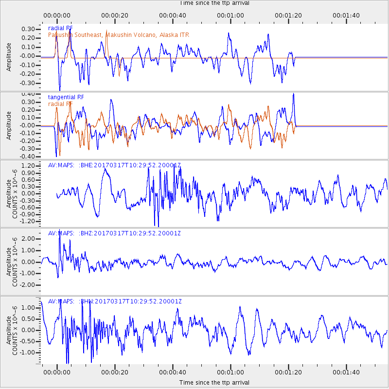
MAPS Pakushin Southeast, Makushin Volcano, Alaska - Earthquake Result Viewer
*The percent match for this event was below the threshold and hence no stack was calculated.
| Earthquake location: |
South Of Fiji Islands |
| Earthquake latitude/longitude: |
-23.6/-176.8 |
| Earthquake time(UTC): |
2017/03/17 (076) 10:18:39 GMT |
| Earthquake Depth: |
109 km |
| Earthquake Magnitude: |
5.5 mb |
| Earthquake Catalog/Contributor: |
NEIC PDE/us |
|
| Network: |
AV Alaska Volcano Observatory |
| Station: |
MAPS Pakushin Southeast, Makushin Volcano, Alaska |
| Lat/Lon: |
53.81 N/166.94 W |
| Elevation: |
333 m |
|
| Distance: |
77.6 deg |
| Az: |
5.951 deg |
| Baz: |
189.228 deg |
| Ray Param: |
$rayparam |
*The percent match for this event was below the threshold and hence was not used in the summary stack. |
|
| Radial Match: |
66.2103 % |
| Radial Bump: |
400 |
| Transverse Match: |
53.32226 % |
| Transverse Bump: |
400 |
| SOD ConfigId: |
11737051 |
| Insert Time: |
2019-04-26 23:09:43.777 +0000 |
| GWidth: |
2.5 |
| Max Bumps: |
400 |
| Tol: |
0.001 |
|
Signal To Noise
| Channel | StoN | STA | LTA |
| AV:MAPS: :BHZ:20170317T10:29:52.20001Z | 2.04682 | 1.0330433E-6 | 5.0470646E-7 |
| AV:MAPS: :BHN:20170317T10:29:52.20001Z | 1.4020964 | 6.663351E-7 | 4.75242E-7 |
| AV:MAPS: :BHE:20170317T10:29:52.20001Z | 1.0850575 | 4.8472015E-7 | 4.4672302E-7 |
| Arrivals |
| Ps | |
| PpPs | |
| PsPs/PpSs | |


