You are here: Home > Network List > TA - USArray Transportable Network (new EarthScope stations) Stations List
> Station L19K White Mountain, AK, USA > Earthquake Result Viewer
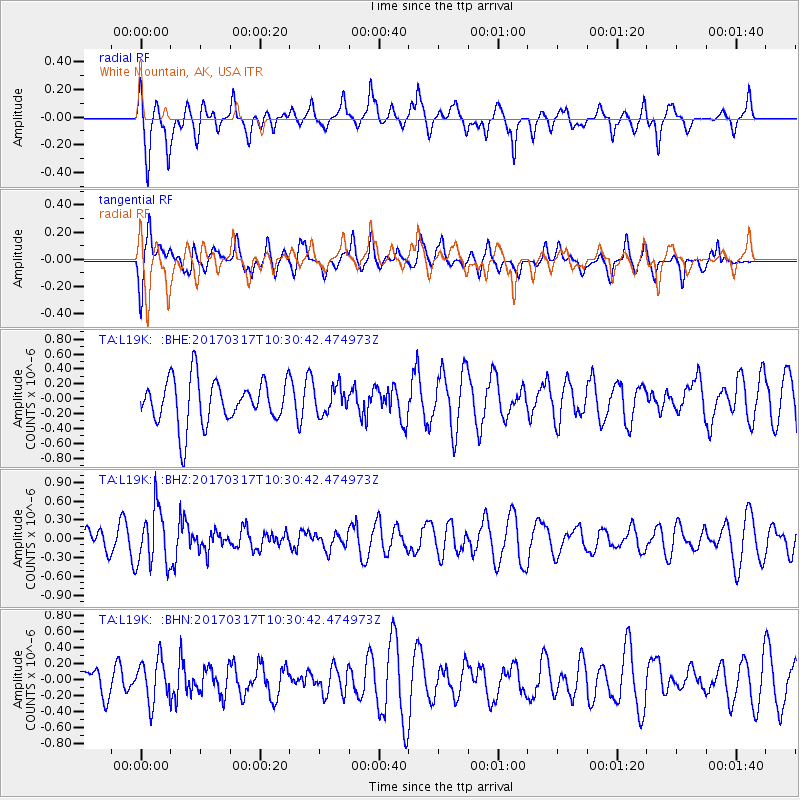
L19K White Mountain, AK, USA - Earthquake Result Viewer
*The percent match for this event was below the threshold and hence no stack was calculated.
| Earthquake location: |
South Of Fiji Islands |
| Earthquake latitude/longitude: |
-23.6/-176.8 |
| Earthquake time(UTC): |
2017/03/17 (076) 10:18:39 GMT |
| Earthquake Depth: |
109 km |
| Earthquake Magnitude: |
5.5 mb |
| Earthquake Catalog/Contributor: |
NEIC PDE/us |
|
| Network: |
TA USArray Transportable Network (new EarthScope stations) |
| Station: |
L19K White Mountain, AK, USA |
| Lat/Lon: |
62.18 N/154.85 W |
| Elevation: |
650 m |
|
| Distance: |
87.3 deg |
| Az: |
10.096 deg |
| Baz: |
200.045 deg |
| Ray Param: |
$rayparam |
*The percent match for this event was below the threshold and hence was not used in the summary stack. |
|
| Radial Match: |
65.81747 % |
| Radial Bump: |
400 |
| Transverse Match: |
57.021034 % |
| Transverse Bump: |
400 |
| SOD ConfigId: |
11737051 |
| Insert Time: |
2019-04-26 23:13:34.870 +0000 |
| GWidth: |
2.5 |
| Max Bumps: |
400 |
| Tol: |
0.001 |
|
Signal To Noise
| Channel | StoN | STA | LTA |
| TA:L19K: :BHZ:20170317T10:30:42.474973Z | 1.7047652 | 4.5366576E-7 | 2.6611627E-7 |
| TA:L19K: :BHN:20170317T10:30:42.474973Z | 1.3561013 | 2.6674255E-7 | 1.9669811E-7 |
| TA:L19K: :BHE:20170317T10:30:42.474973Z | 0.6001548 | 1.808411E-7 | 3.0132406E-7 |
| Arrivals |
| Ps | |
| PpPs | |
| PsPs/PpSs | |


