You are here: Home > Network List > TA - USArray Transportable Network (new EarthScope stations) Stations List
> Station O17K Koliganek, Bristol Bay, AK, USA > Earthquake Result Viewer
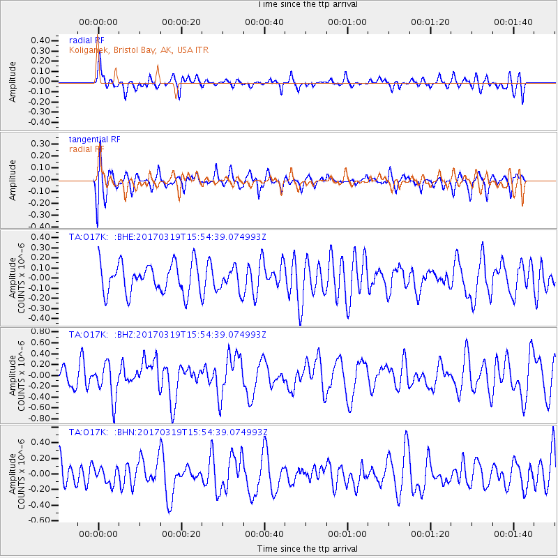
O17K Koliganek, Bristol Bay, AK, USA - Earthquake Result Viewer
*The percent match for this event was below the threshold and hence no stack was calculated.
| Earthquake location: |
Solomon Islands |
| Earthquake latitude/longitude: |
-8.1/160.7 |
| Earthquake time(UTC): |
2017/03/19 (078) 15:43:25 GMT |
| Earthquake Depth: |
4.2 km |
| Earthquake Magnitude: |
6.0 Mww |
| Earthquake Catalog/Contributor: |
NEIC PDE/us |
|
| Network: |
TA USArray Transportable Network (new EarthScope stations) |
| Station: |
O17K Koliganek, Bristol Bay, AK, USA |
| Lat/Lon: |
59.77 N/157.09 W |
| Elevation: |
156 m |
|
| Distance: |
75.5 deg |
| Az: |
20.535 deg |
| Baz: |
223.345 deg |
| Ray Param: |
$rayparam |
*The percent match for this event was below the threshold and hence was not used in the summary stack. |
|
| Radial Match: |
49.57932 % |
| Radial Bump: |
400 |
| Transverse Match: |
52.539917 % |
| Transverse Bump: |
400 |
| SOD ConfigId: |
11737051 |
| Insert Time: |
2019-04-26 23:20:26.235 +0000 |
| GWidth: |
2.5 |
| Max Bumps: |
400 |
| Tol: |
0.001 |
|
Signal To Noise
| Channel | StoN | STA | LTA |
| TA:O17K: :BHZ:20170319T15:54:39.074993Z | 2.3482745 | 3.3818205E-7 | 1.44013E-7 |
| TA:O17K: :BHN:20170319T15:54:39.074993Z | 0.5620333 | 1.00107414E-7 | 1.7811651E-7 |
| TA:O17K: :BHE:20170319T15:54:39.074993Z | 0.7867344 | 1.1551671E-7 | 1.4683063E-7 |
| Arrivals |
| Ps | |
| PpPs | |
| PsPs/PpSs | |


