You are here: Home > Network List > UW - Pacific Northwest Regional Seismic Network Stations List
> Station FISH Seaside, OR, USA > Earthquake Result Viewer
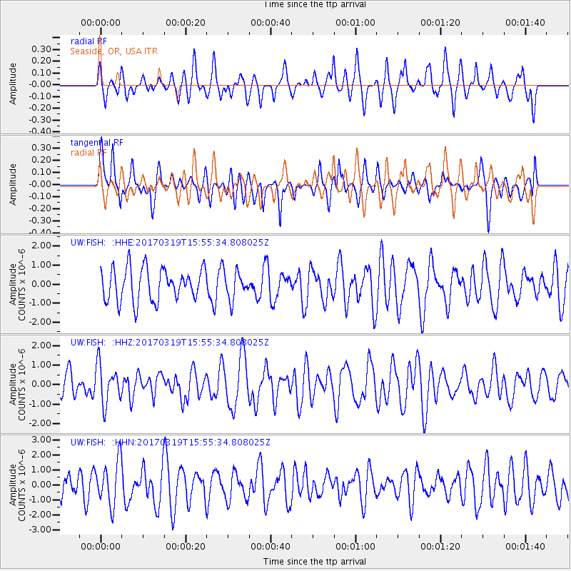
FISH Seaside, OR, USA - Earthquake Result Viewer
*The percent match for this event was below the threshold and hence no stack was calculated.
| Earthquake location: |
Solomon Islands |
| Earthquake latitude/longitude: |
-8.1/160.7 |
| Earthquake time(UTC): |
2017/03/19 (078) 15:43:25 GMT |
| Earthquake Depth: |
4.2 km |
| Earthquake Magnitude: |
6.0 Mww |
| Earthquake Catalog/Contributor: |
NEIC PDE/us |
|
| Network: |
UW Pacific Northwest Regional Seismic Network |
| Station: |
FISH Seaside, OR, USA |
| Lat/Lon: |
45.93 N/123.56 W |
| Elevation: |
325 m |
|
| Distance: |
86.0 deg |
| Az: |
42.686 deg |
| Baz: |
254.097 deg |
| Ray Param: |
$rayparam |
*The percent match for this event was below the threshold and hence was not used in the summary stack. |
|
| Radial Match: |
52.150692 % |
| Radial Bump: |
400 |
| Transverse Match: |
37.707226 % |
| Transverse Bump: |
400 |
| SOD ConfigId: |
11737051 |
| Insert Time: |
2019-04-26 23:22:12.663 +0000 |
| GWidth: |
2.5 |
| Max Bumps: |
400 |
| Tol: |
0.001 |
|
Signal To Noise
| Channel | StoN | STA | LTA |
| UW:FISH: :HHZ:20170319T15:55:34.808025Z | 1.5858805 | 1.0121296E-6 | 6.38213E-7 |
| UW:FISH: :HHN:20170319T15:55:34.808025Z | 2.2033997 | 1.5345248E-6 | 6.9643505E-7 |
| UW:FISH: :HHE:20170319T15:55:34.808025Z | 0.79370785 | 6.77694E-7 | 8.538331E-7 |
| Arrivals |
| Ps | |
| PpPs | |
| PsPs/PpSs | |


