You are here: Home > Network List > CI - Caltech Regional Seismic Network Stations List
> Station BFS Mt Baldy Forest Station > Earthquake Result Viewer
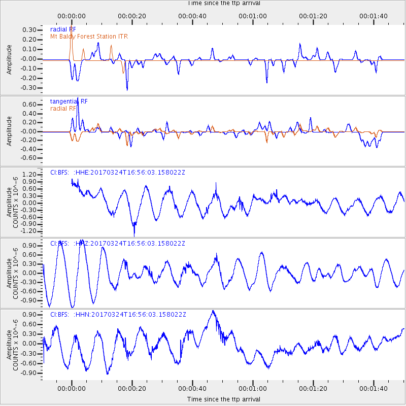
BFS Mt Baldy Forest Station - Earthquake Result Viewer
*The percent match for this event was below the threshold and hence no stack was calculated.
| Earthquake location: |
Ryukyu Islands, Japan |
| Earthquake latitude/longitude: |
26.9/127.2 |
| Earthquake time(UTC): |
2017/03/24 (083) 16:43:27 GMT |
| Earthquake Depth: |
77 km |
| Earthquake Magnitude: |
5.1 Mww |
| Earthquake Catalog/Contributor: |
NEIC PDE/us |
|
| Network: |
CI Caltech Regional Seismic Network |
| Station: |
BFS Mt Baldy Forest Station |
| Lat/Lon: |
34.24 N/117.66 W |
| Elevation: |
1312 m |
|
| Distance: |
93.6 deg |
| Az: |
48.725 deg |
| Baz: |
305.887 deg |
| Ray Param: |
$rayparam |
*The percent match for this event was below the threshold and hence was not used in the summary stack. |
|
| Radial Match: |
37.298794 % |
| Radial Bump: |
400 |
| Transverse Match: |
32.586506 % |
| Transverse Bump: |
400 |
| SOD ConfigId: |
11737051 |
| Insert Time: |
2019-04-26 23:29:11.712 +0000 |
| GWidth: |
2.5 |
| Max Bumps: |
400 |
| Tol: |
0.001 |
|
Signal To Noise
| Channel | StoN | STA | LTA |
| CI:BFS: :HHZ:20170324T16:56:03.158022Z | 1.7243034 | 8.553862E-7 | 4.960764E-7 |
| CI:BFS: :HHN:20170324T16:56:03.158022Z | 2.823166 | 5.954683E-7 | 2.1092218E-7 |
| CI:BFS: :HHE:20170324T16:56:03.158022Z | 0.6682989 | 3.240213E-7 | 4.8484486E-7 |
| Arrivals |
| Ps | |
| PpPs | |
| PsPs/PpSs | |


