You are here: Home > Network List > IW - Intermountain West Stations List
> Station MOOW Moose Ponds, Wyoming, USA > Earthquake Result Viewer
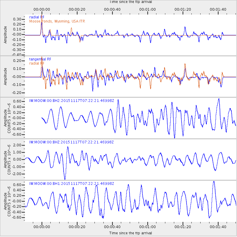
MOOW Moose Ponds, Wyoming, USA - Earthquake Result Viewer
*The percent match for this event was below the threshold and hence no stack was calculated.
| Earthquake location: |
Greece |
| Earthquake latitude/longitude: |
38.8/20.6 |
| Earthquake time(UTC): |
2015/11/17 (321) 07:10:08 GMT |
| Earthquake Depth: |
11 km |
| Earthquake Magnitude: |
6.5 MWB |
| Earthquake Catalog/Contributor: |
NEIC PDE/NEIC COMCAT |
|
| Network: |
IW Intermountain West |
| Station: |
MOOW Moose Ponds, Wyoming, USA |
| Lat/Lon: |
43.75 N/110.74 W |
| Elevation: |
2128 m |
|
| Distance: |
86.8 deg |
| Az: |
326.954 deg |
| Baz: |
36.039 deg |
| Ray Param: |
$rayparam |
*The percent match for this event was below the threshold and hence was not used in the summary stack. |
|
| Radial Match: |
73.30598 % |
| Radial Bump: |
400 |
| Transverse Match: |
65.88641 % |
| Transverse Bump: |
400 |
| SOD ConfigId: |
1259291 |
| Insert Time: |
2015-12-01 07:58:21.938 +0000 |
| GWidth: |
2.5 |
| Max Bumps: |
400 |
| Tol: |
0.001 |
|
Signal To Noise
| Channel | StoN | STA | LTA |
| IW:MOOW:00:BHZ:20151117T07:22:21.46998Z | 4.567276 | 5.881624E-7 | 1.287775E-7 |
| IW:MOOW:00:BH1:20151117T07:22:21.46998Z | 0.7838103 | 1.2387794E-7 | 1.580458E-7 |
| IW:MOOW:00:BH2:20151117T07:22:21.46998Z | 0.9270961 | 1.8045935E-7 | 1.9465008E-7 |
| Arrivals |
| Ps | |
| PpPs | |
| PsPs/PpSs | |


