You are here: Home > Network List > TA - USArray Transportable Network (new EarthScope stations) Stations List
> Station R31K City Hall, Gustavus, AK, USA > Earthquake Result Viewer
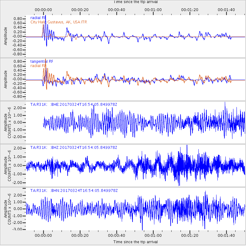
R31K City Hall, Gustavus, AK, USA - Earthquake Result Viewer
*The percent match for this event was below the threshold and hence no stack was calculated.
| Earthquake location: |
Ryukyu Islands, Japan |
| Earthquake latitude/longitude: |
26.9/127.2 |
| Earthquake time(UTC): |
2017/03/24 (083) 16:43:27 GMT |
| Earthquake Depth: |
77 km |
| Earthquake Magnitude: |
5.1 Mww |
| Earthquake Catalog/Contributor: |
NEIC PDE/us |
|
| Network: |
TA USArray Transportable Network (new EarthScope stations) |
| Station: |
R31K City Hall, Gustavus, AK, USA |
| Lat/Lon: |
58.41 N/135.74 W |
| Elevation: |
15 m |
|
| Distance: |
71.0 deg |
| Az: |
33.529 deg |
| Baz: |
290.413 deg |
| Ray Param: |
$rayparam |
*The percent match for this event was below the threshold and hence was not used in the summary stack. |
|
| Radial Match: |
54.8383 % |
| Radial Bump: |
400 |
| Transverse Match: |
45.195328 % |
| Transverse Bump: |
400 |
| SOD ConfigId: |
11737051 |
| Insert Time: |
2019-04-26 23:33:25.167 +0000 |
| GWidth: |
2.5 |
| Max Bumps: |
400 |
| Tol: |
0.001 |
|
Signal To Noise
| Channel | StoN | STA | LTA |
| TA:R31K: :BHZ:20170324T16:54:05.849978Z | 1.1513116 | 4.2701902E-7 | 3.7089785E-7 |
| TA:R31K: :BHN:20170324T16:54:05.849978Z | 1.4034492 | 1.035839E-6 | 7.380666E-7 |
| TA:R31K: :BHE:20170324T16:54:05.849978Z | 1.2114571 | 7.9452195E-7 | 6.558399E-7 |
| Arrivals |
| Ps | |
| PpPs | |
| PsPs/PpSs | |


