You are here: Home > Network List > TA - USArray Transportable Network (new EarthScope stations) Stations List
> Station I23K Minto, Yukon-Koyukuk, AK, USA > Earthquake Result Viewer
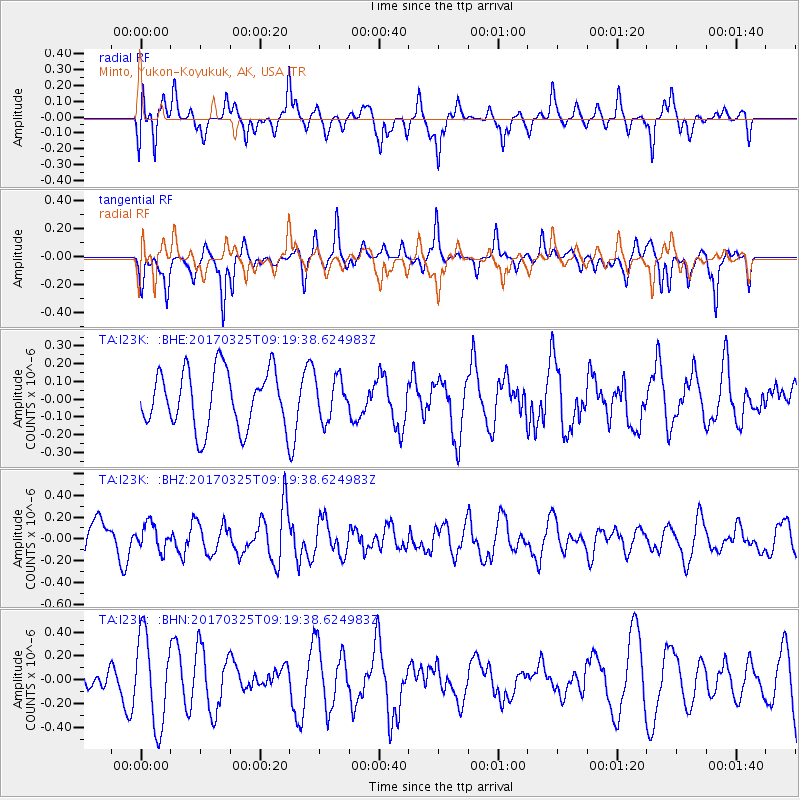
I23K Minto, Yukon-Koyukuk, AK, USA - Earthquake Result Viewer
*The percent match for this event was below the threshold and hence no stack was calculated.
| Earthquake location: |
Eastern New Guinea Reg., P.N.G. |
| Earthquake latitude/longitude: |
-5.2/145.4 |
| Earthquake time(UTC): |
2017/03/25 (084) 09:07:47 GMT |
| Earthquake Depth: |
95 km |
| Earthquake Magnitude: |
5.2 Mww |
| Earthquake Catalog/Contributor: |
NEIC PDE/us |
|
| Network: |
TA USArray Transportable Network (new EarthScope stations) |
| Station: |
I23K Minto, Yukon-Koyukuk, AK, USA |
| Lat/Lon: |
65.15 N/149.36 W |
| Elevation: |
149 m |
|
| Distance: |
84.6 deg |
| Az: |
22.678 deg |
| Baz: |
245.313 deg |
| Ray Param: |
$rayparam |
*The percent match for this event was below the threshold and hence was not used in the summary stack. |
|
| Radial Match: |
59.760555 % |
| Radial Bump: |
400 |
| Transverse Match: |
53.63576 % |
| Transverse Bump: |
291 |
| SOD ConfigId: |
11737051 |
| Insert Time: |
2019-04-26 23:38:21.199 +0000 |
| GWidth: |
2.5 |
| Max Bumps: |
400 |
| Tol: |
0.001 |
|
Signal To Noise
| Channel | StoN | STA | LTA |
| TA:I23K: :BHZ:20170325T09:19:38.624983Z | 0.8141869 | 1.2032817E-7 | 1.4778938E-7 |
| TA:I23K: :BHN:20170325T09:19:38.624983Z | 1.8686442 | 3.7730834E-7 | 2.0191554E-7 |
| TA:I23K: :BHE:20170325T09:19:38.624983Z | 0.6865603 | 1.1309341E-7 | 1.6472467E-7 |
| Arrivals |
| Ps | |
| PpPs | |
| PsPs/PpSs | |


