You are here: Home > Network List > CI - Caltech Regional Seismic Network Stations List
> Station DAN Danby, California, USA > Earthquake Result Viewer
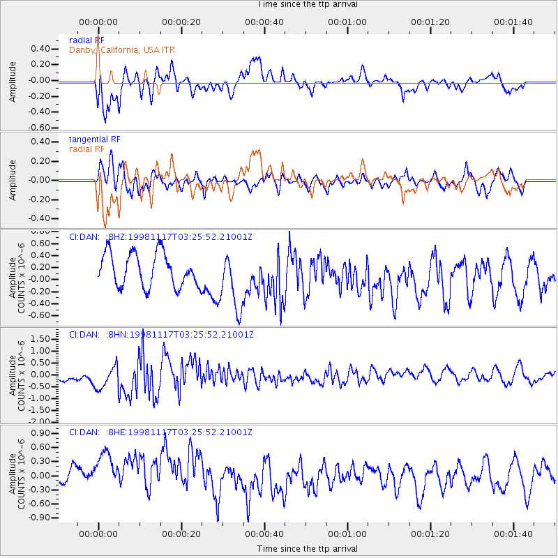
DAN Danby, California, USA - Earthquake Result Viewer
*The percent match for this event was below the threshold and hence no stack was calculated.
| Earthquake location: |
Easter Island Region |
| Earthquake latitude/longitude: |
-26.8/-113.3 |
| Earthquake time(UTC): |
1998/11/17 (321) 03:16:08 GMT |
| Earthquake Depth: |
10 km |
| Earthquake Magnitude: |
5.4 MB, 5.5 MS |
| Earthquake Catalog/Contributor: |
WHDF/NEIC |
|
| Network: |
CI Caltech Regional Seismic Network |
| Station: |
DAN Danby, California, USA |
| Lat/Lon: |
34.64 N/115.38 W |
| Elevation: |
398 m |
|
| Distance: |
61.2 deg |
| Az: |
358.032 deg |
| Baz: |
177.868 deg |
| Ray Param: |
$rayparam |
*The percent match for this event was below the threshold and hence was not used in the summary stack. |
|
| Radial Match: |
73.29434 % |
| Radial Bump: |
400 |
| Transverse Match: |
67.10802 % |
| Transverse Bump: |
400 |
| SOD ConfigId: |
4480 |
| Insert Time: |
2010-02-26 01:05:20.353 +0000 |
| GWidth: |
2.5 |
| Max Bumps: |
400 |
| Tol: |
0.001 |
|
Signal To Noise
| Channel | StoN | STA | LTA |
| CI:DAN: :BHN:19981117T03:25:52.21001Z | 2.6469376 | 5.8884723E-7 | 2.224636E-7 |
| CI:DAN: :BHE:19981117T03:25:52.21001Z | 2.8057122 | 7.628174E-7 | 2.7188014E-7 |
| CI:DAN: :BHZ:19981117T03:25:52.21001Z | 1.8058116 | 4.972521E-7 | 2.7536208E-7 |
| Arrivals |
| Ps | |
| PpPs | |
| PsPs/PpSs | |


