You are here: Home > Network List > WY - Yellowstone Wyoming Seismic Network Stations List
> Station YHH Holmes Hill, YNP, WY, USA > Earthquake Result Viewer
YHH Holmes Hill, YNP, WY, USA - Earthquake Result Viewer
*The percent match for this event was below the threshold and hence no stack was calculated.
| Earthquake location: |
Greece |
| Earthquake latitude/longitude: |
38.8/20.6 |
| Earthquake time(UTC): |
2015/11/17 (321) 07:10:08 GMT |
| Earthquake Depth: |
11 km |
| Earthquake Magnitude: |
6.5 MWB |
| Earthquake Catalog/Contributor: |
NEIC PDE/NEIC COMCAT |
|
| Network: |
WY Yellowstone Wyoming Seismic Network |
| Station: |
YHH Holmes Hill, YNP, WY, USA |
| Lat/Lon: |
44.79 N/110.85 W |
| Elevation: |
2717 m |
|
| Distance: |
86.0 deg |
| Az: |
327.628 deg |
| Baz: |
36.008 deg |
| Ray Param: |
$rayparam |
*The percent match for this event was below the threshold and hence was not used in the summary stack. |
|
| Radial Match: |
56.108982 % |
| Radial Bump: |
280 |
| Transverse Match: |
66.68687 % |
| Transverse Bump: |
379 |
| SOD ConfigId: |
1259291 |
| Insert Time: |
2015-12-01 08:07:01.908 +0000 |
| GWidth: |
2.5 |
| Max Bumps: |
400 |
| Tol: |
0.001 |
|
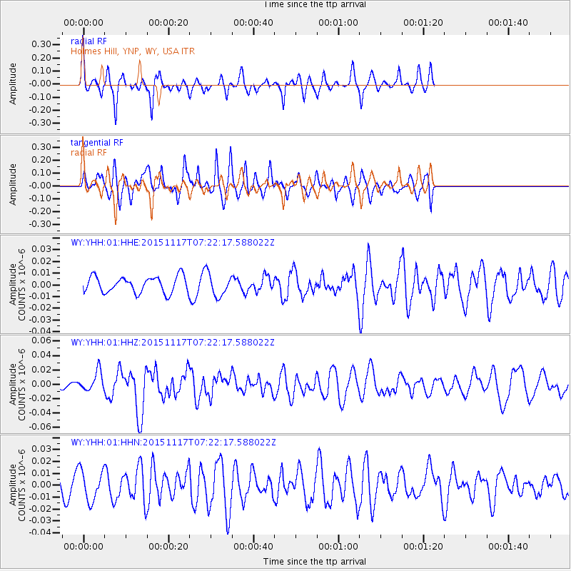
Signal To Noise
| Channel | StoN | STA | LTA |
| WY:YHH:01:HHZ:20151117T07:22:17.588022Z | 3.1226735 | 1.4091731E-8 | 4.5127138E-9 |
| WY:YHH:01:HHN:20151117T07:22:17.588022Z | 1.8882192 | 1.285657E-8 | 6.808833E-9 |
| WY:YHH:01:HHE:20151117T07:22:17.588022Z | 1.3811334 | 9.439936E-9 | 6.8349193E-9 |
| Arrivals |
| Ps | |
| PpPs | |
| PsPs/PpSs | |


