You are here: Home > Network List > CI - Caltech Regional Seismic Network Stations List
> Station HEC Hector, Baker, CA, USA > Earthquake Result Viewer
HEC Hector, Baker, CA, USA - Earthquake Result Viewer
*The percent match for this event was below the threshold and hence no stack was calculated.
| Earthquake location: |
Southeast Of Loyalty Islands |
| Earthquake latitude/longitude: |
-22.5/171.2 |
| Earthquake time(UTC): |
2008/11/22 (327) 16:01:39 GMT |
| Earthquake Depth: |
57 km |
| Earthquake Magnitude: |
5.7 MB, 6.4 MW, 6.4 MW |
| Earthquake Catalog/Contributor: |
WHDF/NEIC |
|
| Network: |
CI Caltech Regional Seismic Network |
| Station: |
HEC Hector, Baker, CA, USA |
| Lat/Lon: |
34.83 N/116.33 W |
| Elevation: |
920 m |
|
| Distance: |
89.3 deg |
| Az: |
51.673 deg |
| Baz: |
241.853 deg |
| Ray Param: |
$rayparam |
*The percent match for this event was below the threshold and hence was not used in the summary stack. |
|
| Radial Match: |
55.819813 % |
| Radial Bump: |
400 |
| Transverse Match: |
56.708252 % |
| Transverse Bump: |
400 |
| SOD ConfigId: |
2658 |
| Insert Time: |
2010-03-05 22:36:44.715 +0000 |
| GWidth: |
2.5 |
| Max Bumps: |
400 |
| Tol: |
0.001 |
|
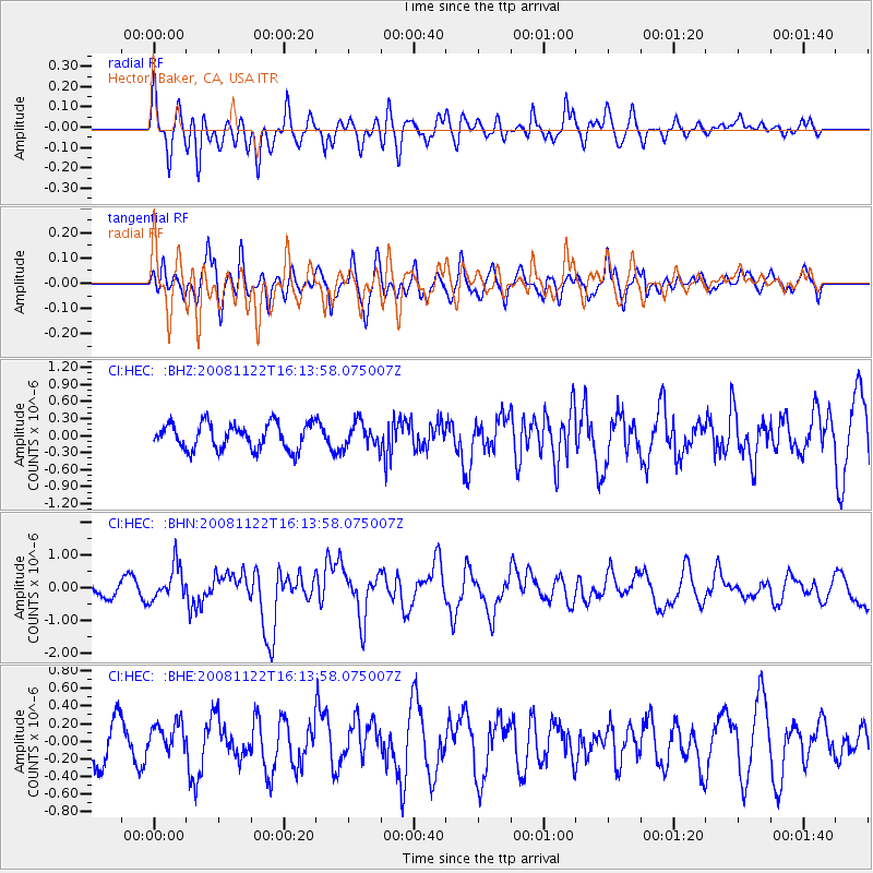
Signal To Noise
| Channel | StoN | STA | LTA |
| CI:HEC: :BHN:20081122T16:13:58.075007Z | 2.4695559 | 5.327271E-7 | 2.1571779E-7 |
| CI:HEC: :BHE:20081122T16:13:58.075007Z | 0.9115647 | 1.6686235E-7 | 1.8305046E-7 |
| CI:HEC: :BHZ:20081122T16:13:58.075007Z | 0.93473655 | 2.1270046E-7 | 2.2755124E-7 |
| Arrivals |
| Ps | |
| PpPs | |
| PsPs/PpSs | |


