You are here: Home > Network List > TA - USArray Transportable Network (new EarthScope stations) Stations List
> Station MSTX Muleshoe, TX, USA > Earthquake Result Viewer
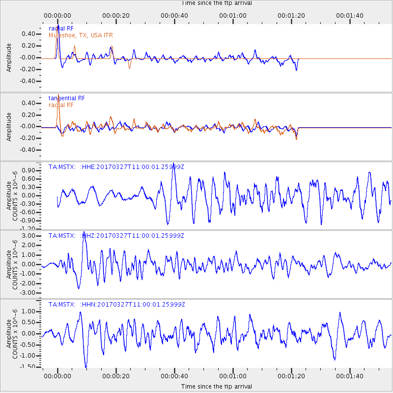
MSTX Muleshoe, TX, USA - Earthquake Result Viewer
*The percent match for this event was below the threshold and hence no stack was calculated.
| Earthquake location: |
Near Islands, Aleutian Islands |
| Earthquake latitude/longitude: |
52.8/172.2 |
| Earthquake time(UTC): |
2017/03/27 (086) 10:50:19 GMT |
| Earthquake Depth: |
10 km |
| Earthquake Magnitude: |
6.1 Mww |
| Earthquake Catalog/Contributor: |
NEIC PDE/us |
|
| Network: |
TA USArray Transportable Network (new EarthScope stations) |
| Station: |
MSTX Muleshoe, TX, USA |
| Lat/Lon: |
33.97 N/102.77 W |
| Elevation: |
1167 m |
|
| Distance: |
60.9 deg |
| Az: |
71.285 deg |
| Baz: |
316.211 deg |
| Ray Param: |
$rayparam |
*The percent match for this event was below the threshold and hence was not used in the summary stack. |
|
| Radial Match: |
77.41618 % |
| Radial Bump: |
343 |
| Transverse Match: |
58.776676 % |
| Transverse Bump: |
341 |
| SOD ConfigId: |
11737051 |
| Insert Time: |
2019-04-26 23:55:59.006 +0000 |
| GWidth: |
2.5 |
| Max Bumps: |
400 |
| Tol: |
0.001 |
|
Signal To Noise
| Channel | StoN | STA | LTA |
| TA:MSTX: :HHZ:20170327T11:00:01.25999Z | 5.0368237 | 4.5063138E-7 | 8.946736E-8 |
| TA:MSTX: :HHN:20170327T11:00:01.25999Z | 1.2833123 | 2.4635375E-7 | 1.919671E-7 |
| TA:MSTX: :HHE:20170327T11:00:01.25999Z | 1.1262996 | 2.0881548E-7 | 1.8539959E-7 |
| Arrivals |
| Ps | |
| PpPs | |
| PsPs/PpSs | |


