You are here: Home > Network List > CI - Caltech Regional Seismic Network Stations List
> Station HEC Hector, Baker, CA, USA > Earthquake Result Viewer
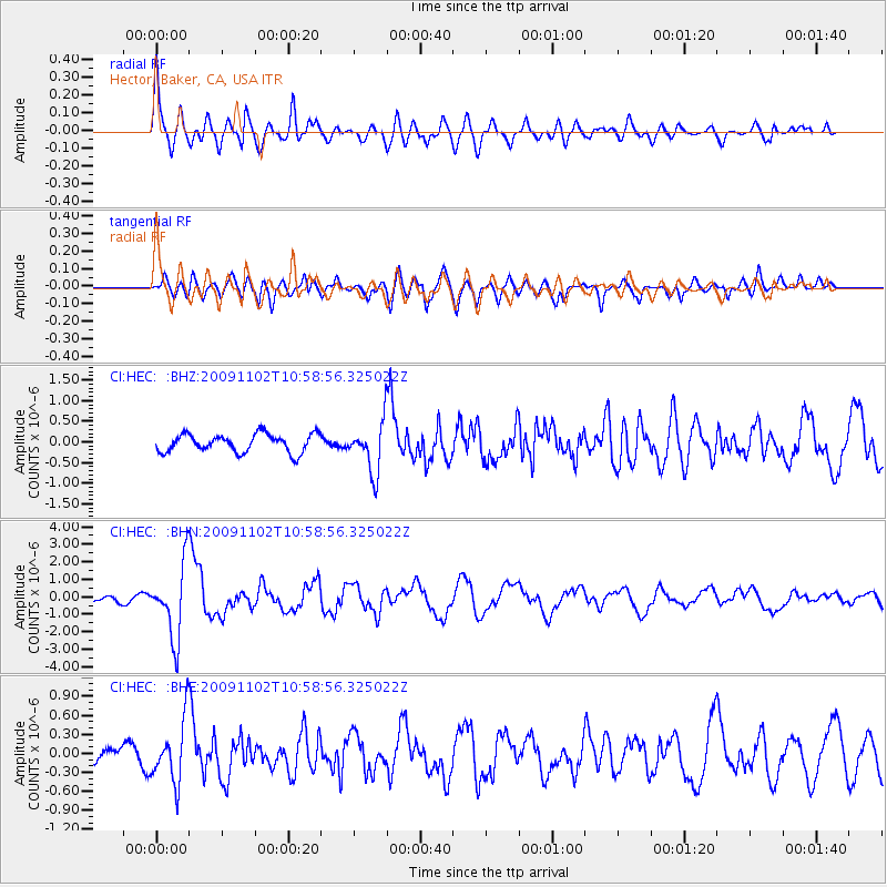
HEC Hector, Baker, CA, USA - Earthquake Result Viewer
*The percent match for this event was below the threshold and hence no stack was calculated.
| Earthquake location: |
South Of Tonga Islands |
| Earthquake latitude/longitude: |
-24.1/-175.2 |
| Earthquake time(UTC): |
2009/11/02 (306) 10:47:13 GMT |
| Earthquake Depth: |
9.0 km |
| Earthquake Magnitude: |
6.1 MB, 6.1 MS, 6.2 MW, 6.1 MW |
| Earthquake Catalog/Contributor: |
WHDF/NEIC |
|
| Network: |
CI Caltech Regional Seismic Network |
| Station: |
HEC Hector, Baker, CA, USA |
| Lat/Lon: |
34.83 N/116.33 W |
| Elevation: |
920 m |
|
| Distance: |
80.9 deg |
| Az: |
45.471 deg |
| Baz: |
232.354 deg |
| Ray Param: |
$rayparam |
*The percent match for this event was below the threshold and hence was not used in the summary stack. |
|
| Radial Match: |
79.4979 % |
| Radial Bump: |
400 |
| Transverse Match: |
73.255936 % |
| Transverse Bump: |
400 |
| SOD ConfigId: |
2622 |
| Insert Time: |
2010-03-05 22:37:18.028 +0000 |
| GWidth: |
2.5 |
| Max Bumps: |
400 |
| Tol: |
0.001 |
|
Signal To Noise
| Channel | StoN | STA | LTA |
| CI:HEC: :BHN:20091102T10:58:56.325022Z | 9.915929 | 2.0678444E-6 | 2.0853764E-7 |
| CI:HEC: :BHE:20091102T10:58:56.325022Z | 3.0640554 | 4.913528E-7 | 1.6036029E-7 |
| CI:HEC: :BHZ:20091102T10:58:56.325022Z | 2.7864046 | 6.143343E-7 | 2.2047561E-7 |
| Arrivals |
| Ps | |
| PpPs | |
| PsPs/PpSs | |


