You are here: Home > Network List > AZ - ANZA Regional Network Stations List
> Station SMER AZ.SMER > Earthquake Result Viewer
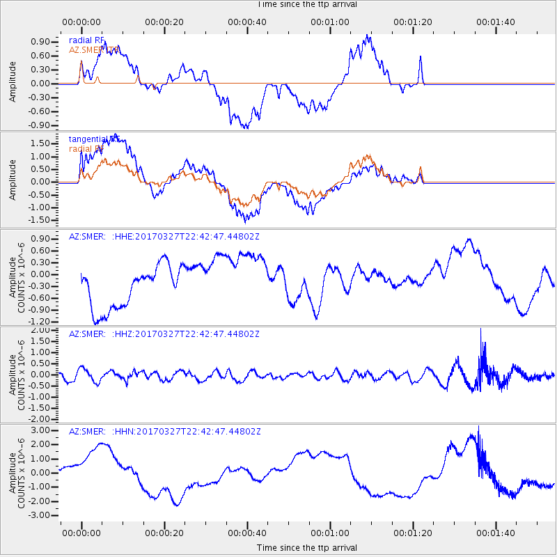
SMER AZ.SMER - Earthquake Result Viewer
*The percent match for this event was below the threshold and hence no stack was calculated.
| Earthquake location: |
Eastern Sea Of Japan |
| Earthquake latitude/longitude: |
42.1/138.5 |
| Earthquake time(UTC): |
2017/03/27 (086) 22:31:21 GMT |
| Earthquake Depth: |
10 km |
| Earthquake Magnitude: |
5.1 Mww |
| Earthquake Catalog/Contributor: |
NEIC PDE/us |
|
| Network: |
AZ ANZA Regional Network |
| Station: |
SMER AZ.SMER |
| Lat/Lon: |
33.46 N/117.17 W |
| Elevation: |
355 m |
|
| Distance: |
77.7 deg |
| Az: |
56.005 deg |
| Baz: |
312.388 deg |
| Ray Param: |
$rayparam |
*The percent match for this event was below the threshold and hence was not used in the summary stack. |
|
| Radial Match: |
28.848278 % |
| Radial Bump: |
400 |
| Transverse Match: |
22.998014 % |
| Transverse Bump: |
400 |
| SOD ConfigId: |
11737051 |
| Insert Time: |
2019-04-27 00:00:29.073 +0000 |
| GWidth: |
2.5 |
| Max Bumps: |
400 |
| Tol: |
0.001 |
|
Signal To Noise
| Channel | StoN | STA | LTA |
| AZ:SMER: :HHZ:20170327T22:42:47.44802Z | 1.7804536 | 3.0549882E-7 | 1.7158483E-7 |
| AZ:SMER: :HHN:20170327T22:42:47.44802Z | 1.3578176 | 2.2674105E-6 | 1.6698933E-6 |
| AZ:SMER: :HHE:20170327T22:42:47.44802Z | 1.3998482 | 7.249263E-7 | 5.178606E-7 |
| Arrivals |
| Ps | |
| PpPs | |
| PsPs/PpSs | |


