You are here: Home > Network List > CI - Caltech Regional Seismic Network Stations List
> Station HEC Hector, Baker, CA, USA > Earthquake Result Viewer
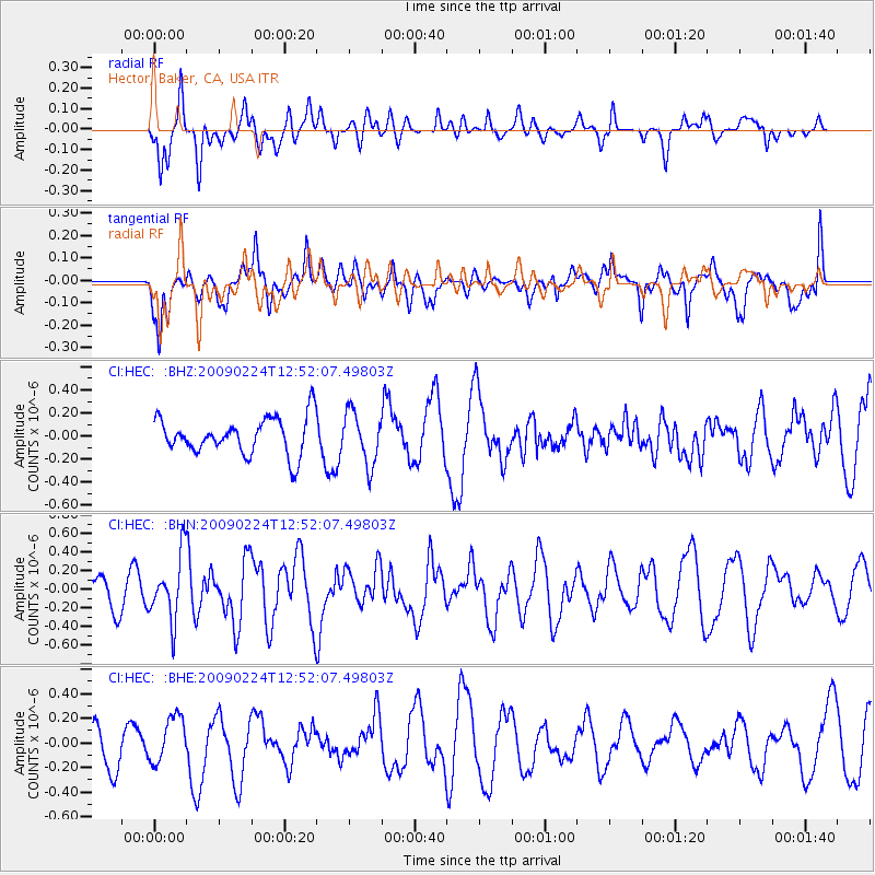
HEC Hector, Baker, CA, USA - Earthquake Result Viewer
*The percent match for this event was below the threshold and hence no stack was calculated.
| Earthquake location: |
Southeast Of Loyalty Islands |
| Earthquake latitude/longitude: |
-23.2/170.6 |
| Earthquake time(UTC): |
2009/02/24 (055) 12:39:41 GMT |
| Earthquake Depth: |
32 km |
| Earthquake Magnitude: |
5.6 MB, 5.7 MW, 5.6 MW |
| Earthquake Catalog/Contributor: |
WHDF/NEIC |
|
| Network: |
CI Caltech Regional Seismic Network |
| Station: |
HEC Hector, Baker, CA, USA |
| Lat/Lon: |
34.83 N/116.33 W |
| Elevation: |
920 m |
|
| Distance: |
90.1 deg |
| Az: |
51.921 deg |
| Baz: |
241.706 deg |
| Ray Param: |
$rayparam |
*The percent match for this event was below the threshold and hence was not used in the summary stack. |
|
| Radial Match: |
67.62708 % |
| Radial Bump: |
400 |
| Transverse Match: |
42.959816 % |
| Transverse Bump: |
348 |
| SOD ConfigId: |
2658 |
| Insert Time: |
2010-03-05 22:37:24.497 +0000 |
| GWidth: |
2.5 |
| Max Bumps: |
400 |
| Tol: |
0.001 |
|
Signal To Noise
| Channel | StoN | STA | LTA |
| CI:HEC: :BHN:20090224T12:52:07.49803Z | 2.5589147 | 3.4109058E-7 | 1.3329502E-7 |
| CI:HEC: :BHE:20090224T12:52:07.49803Z | 1.4371614 | 1.8697563E-7 | 1.3010064E-7 |
| CI:HEC: :BHZ:20090224T12:52:07.49803Z | 1.4154575 | 2.247881E-7 | 1.588095E-7 |
| Arrivals |
| Ps | |
| PpPs | |
| PsPs/PpSs | |


