You are here: Home > Network List > CI - Caltech Regional Seismic Network Stations List
> Station BAR Barrett, Tecate, CA, USA > Earthquake Result Viewer
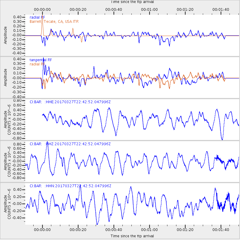
BAR Barrett, Tecate, CA, USA - Earthquake Result Viewer
*The percent match for this event was below the threshold and hence no stack was calculated.
| Earthquake location: |
Eastern Sea Of Japan |
| Earthquake latitude/longitude: |
42.1/138.5 |
| Earthquake time(UTC): |
2017/03/27 (086) 22:31:21 GMT |
| Earthquake Depth: |
10 km |
| Earthquake Magnitude: |
5.1 Mww |
| Earthquake Catalog/Contributor: |
NEIC PDE/us |
|
| Network: |
CI Caltech Regional Seismic Network |
| Station: |
BAR Barrett, Tecate, CA, USA |
| Lat/Lon: |
32.68 N/116.67 W |
| Elevation: |
521 m |
|
| Distance: |
78.6 deg |
| Az: |
56.299 deg |
| Baz: |
312.72 deg |
| Ray Param: |
$rayparam |
*The percent match for this event was below the threshold and hence was not used in the summary stack. |
|
| Radial Match: |
38.55339 % |
| Radial Bump: |
400 |
| Transverse Match: |
70.004036 % |
| Transverse Bump: |
400 |
| SOD ConfigId: |
11737051 |
| Insert Time: |
2019-04-27 00:01:03.414 +0000 |
| GWidth: |
2.5 |
| Max Bumps: |
400 |
| Tol: |
0.001 |
|
Signal To Noise
| Channel | StoN | STA | LTA |
| CI:BAR: :HHZ:20170327T22:42:52.047996Z | 1.77864 | 4.4210074E-7 | 2.485611E-7 |
| CI:BAR: :HHN:20170327T22:42:52.047996Z | 0.97482896 | 1.6372944E-7 | 1.679571E-7 |
| CI:BAR: :HHE:20170327T22:42:52.047996Z | 2.3254266 | 3.8071514E-7 | 1.637184E-7 |
| Arrivals |
| Ps | |
| PpPs | |
| PsPs/PpSs | |


