You are here: Home > Network List > TA - USArray Transportable Network (new EarthScope stations) Stations List
> Station R31K City Hall, Gustavus, AK, USA > Earthquake Result Viewer
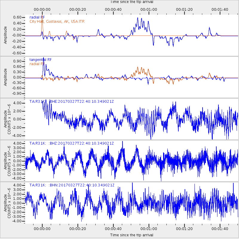
R31K City Hall, Gustavus, AK, USA - Earthquake Result Viewer
*The percent match for this event was below the threshold and hence no stack was calculated.
| Earthquake location: |
Eastern Sea Of Japan |
| Earthquake latitude/longitude: |
42.1/138.5 |
| Earthquake time(UTC): |
2017/03/27 (086) 22:31:21 GMT |
| Earthquake Depth: |
10 km |
| Earthquake Magnitude: |
5.1 Mww |
| Earthquake Catalog/Contributor: |
NEIC PDE/us |
|
| Network: |
TA USArray Transportable Network (new EarthScope stations) |
| Station: |
R31K City Hall, Gustavus, AK, USA |
| Lat/Lon: |
58.41 N/135.74 W |
| Elevation: |
15 m |
|
| Distance: |
53.4 deg |
| Az: |
40.85 deg |
| Baz: |
292.259 deg |
| Ray Param: |
$rayparam |
*The percent match for this event was below the threshold and hence was not used in the summary stack. |
|
| Radial Match: |
42.700844 % |
| Radial Bump: |
400 |
| Transverse Match: |
86.214325 % |
| Transverse Bump: |
400 |
| SOD ConfigId: |
11737051 |
| Insert Time: |
2019-04-27 00:06:05.297 +0000 |
| GWidth: |
2.5 |
| Max Bumps: |
400 |
| Tol: |
0.001 |
|
Signal To Noise
| Channel | StoN | STA | LTA |
| TA:R31K: :BHZ:20170327T22:40:10.349021Z | 1.4081132 | 1.1146083E-6 | 7.915616E-7 |
| TA:R31K: :BHN:20170327T22:40:10.349021Z | 1.1830633 | 1.4968628E-6 | 1.2652433E-6 |
| TA:R31K: :BHE:20170327T22:40:10.349021Z | 0.9790211 | 1.5064234E-6 | 1.5387037E-6 |
| Arrivals |
| Ps | |
| PpPs | |
| PsPs/PpSs | |


