You are here: Home > Network List > CI - Caltech Regional Seismic Network Stations List
> Station DAN Danby, California, USA > Earthquake Result Viewer
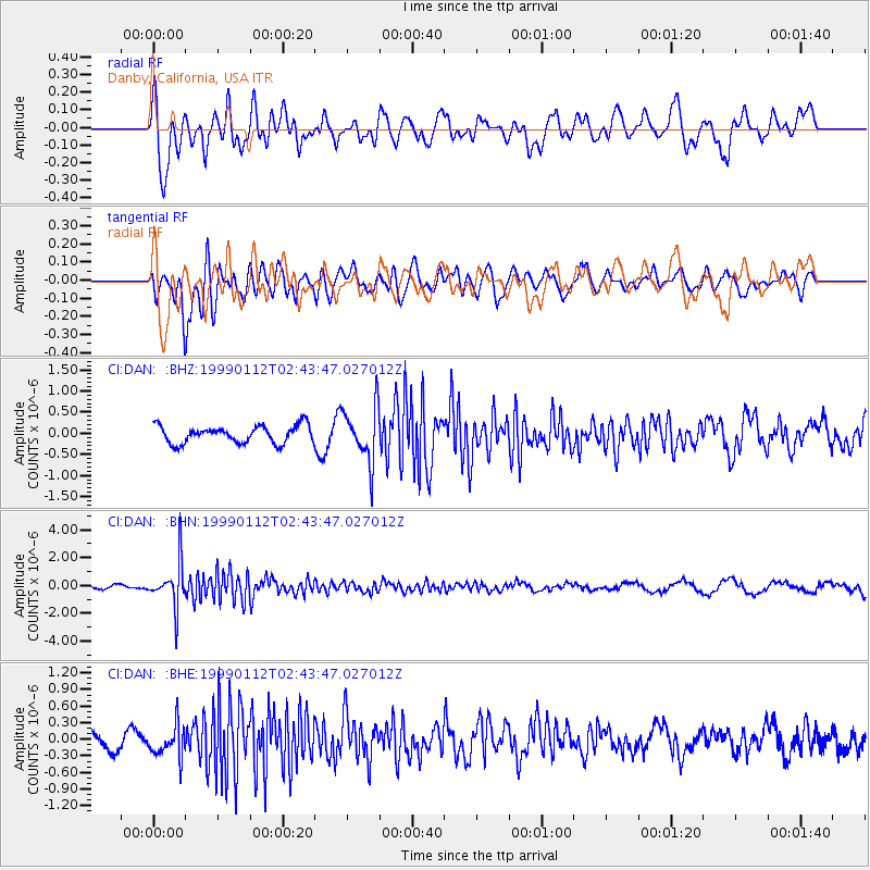
DAN Danby, California, USA - Earthquake Result Viewer
*The percent match for this event was below the threshold and hence no stack was calculated.
| Earthquake location: |
Bonin Islands, Japan Region |
| Earthquake latitude/longitude: |
26.7/140.2 |
| Earthquake time(UTC): |
1999/01/12 (012) 02:32:25 GMT |
| Earthquake Depth: |
441 km |
| Earthquake Magnitude: |
5.9 MB, 6.1 MW, 5.9 MW |
| Earthquake Catalog/Contributor: |
WHDF/NEIC |
|
| Network: |
CI Caltech Regional Seismic Network |
| Station: |
DAN Danby, California, USA |
| Lat/Lon: |
34.64 N/115.38 W |
| Elevation: |
398 m |
|
| Distance: |
86.0 deg |
| Az: |
53.167 deg |
| Baz: |
299.767 deg |
| Ray Param: |
$rayparam |
*The percent match for this event was below the threshold and hence was not used in the summary stack. |
|
| Radial Match: |
65.301994 % |
| Radial Bump: |
400 |
| Transverse Match: |
72.170074 % |
| Transverse Bump: |
400 |
| SOD ConfigId: |
4480 |
| Insert Time: |
2010-02-26 01:05:26.009 +0000 |
| GWidth: |
2.5 |
| Max Bumps: |
400 |
| Tol: |
0.001 |
|
Signal To Noise
| Channel | StoN | STA | LTA |
| CI:DAN: :BHN:19990112T02:43:47.027012Z | 10.972848 | 1.5813358E-6 | 1.4411353E-7 |
| CI:DAN: :BHE:19990112T02:43:47.027012Z | 1.6870987 | 2.856392E-7 | 1.6930792E-7 |
| CI:DAN: :BHZ:19990112T02:43:47.027012Z | 3.1632988 | 6.5525074E-7 | 2.071416E-7 |
| Arrivals |
| Ps | |
| PpPs | |
| PsPs/PpSs | |


