
F04A Amboy, WA, USA - Earthquake Result Viewer
| ||||||||||||||||||
| ||||||||||||||||||
| ||||||||||||||||||
|
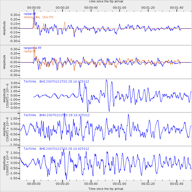
Signal To Noise
| Channel | StoN | STA | LTA |
| TA:F04A: :BHN:20070131T03:28:19.92501Z | 1.2325623 | 3.2941875E-7 | 2.6726337E-7 |
| TA:F04A: :BHE:20070131T03:28:19.92501Z | 0.5995815 | 2.8178582E-7 | 4.6997081E-7 |
| TA:F04A: :BHZ:20070131T03:28:19.92501Z | 4.2163095 | 1.1436032E-6 | 2.7123318E-7 |
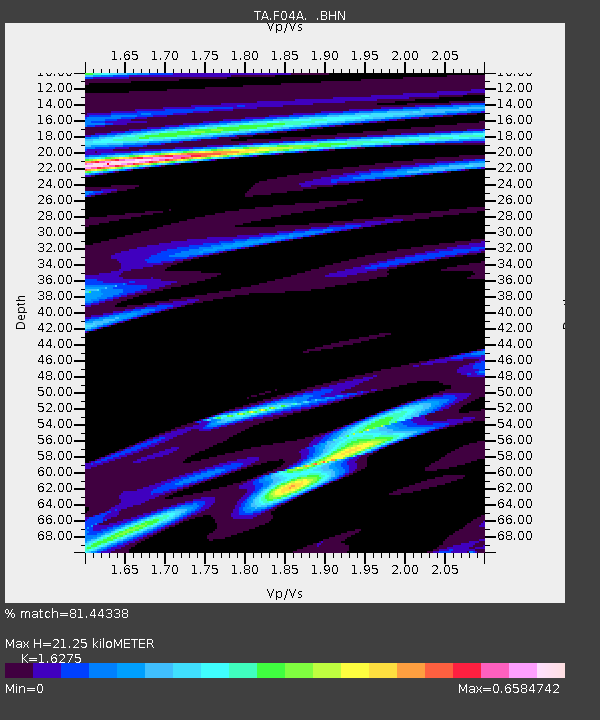
| Arrivals | |
| Ps | 2.1 SECOND |
| PpPs | 8.3 SECOND |
| PsPs/PpSs | 10 SECOND |

