F04A Amboy, WA, USA - Earthquake Result Viewer
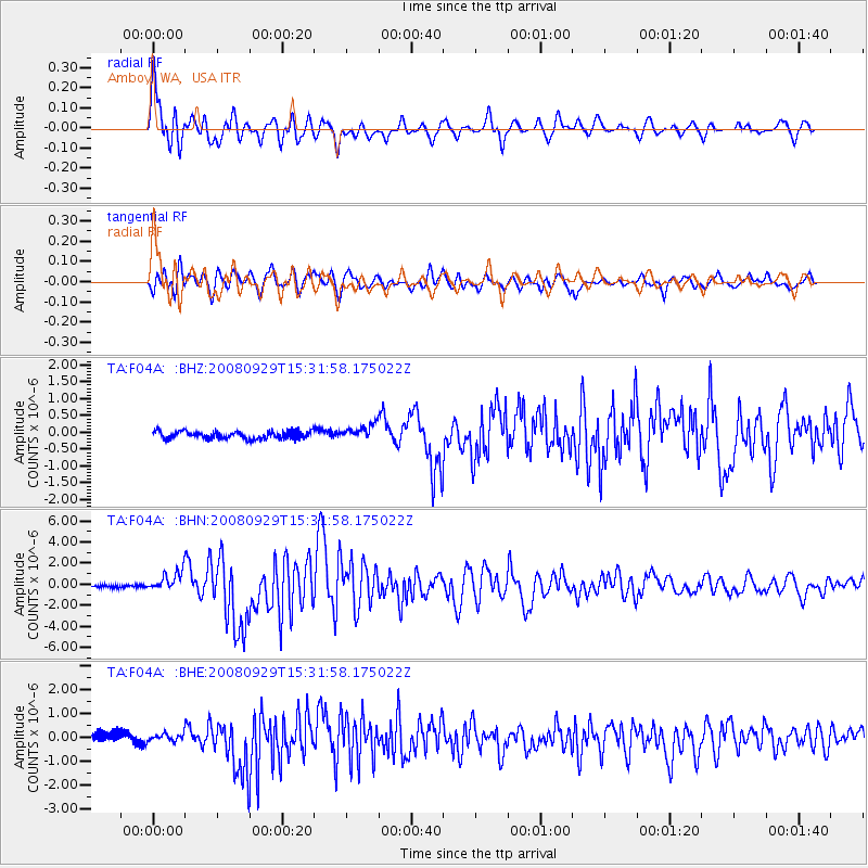
Earthquake location: Kermadec Islands, New Zealand
Earthquake latitude/longitude: -29.8/-177.7
Earthquake time(UTC): 2008/09/29 (273) 15:19:31 GMT
Earthquake Depth: 36 km
Earthquake Magnitude: 6.5 MB, 6.7 MS, 7.0 MW, 7.0 MW
Earthquake Catalog/Contributor: WHDF/NEIC
Network: TA USArray Transportable Network (new EarthScope stations)
Station: F04A Amboy, WA, USA
Lat/Lon: 45.93 N/122.42 W
Elevation: 211 m
Distance: 90.4 deg
Az: 34.998 deg
Baz: 225.613 deg
Ray Param: 0.041667994
Estimated Moho Depth: 46.75 km
Estimated Crust Vp/Vs: 2.10
Assumed Crust Vp: 6.566 km/s
Estimated Crust Vs: 3.13 km/s
Estimated Crust Poisson's Ratio: 0.35
Radial Match: 92.69632 %
Radial Bump: 400
Transverse Match: 82.76664 %
Transverse Bump: 400
SOD ConfigId: 2560
Insert Time: 2010-03-05 22:39:31.749 +0000
GWidth: 2.5
Max Bumps: 400
Tol: 0.001

Signal To Noise

ChannelStoNSTALTA
TA:F04A: :BHN:20080929T15:31:58.175022Z7.46111879.4148334E-71.2618527E-7
TA:F04A: :BHE:20080929T15:31:58.175022Z0.90599871.445285E-71.5952395E-7
TA:F04A: :BHZ:20080929T15:31:58.175022Z2.02340962.241649E-71.1078573E-7
Arrivals
Ps8.0 SECOND
PpPs22 SECOND
PsPs/PpSs30 SECOND