
F04A Amboy, WA, USA - Earthquake Result Viewer
| ||||||||||||||||||
| ||||||||||||||||||
| ||||||||||||||||||
|
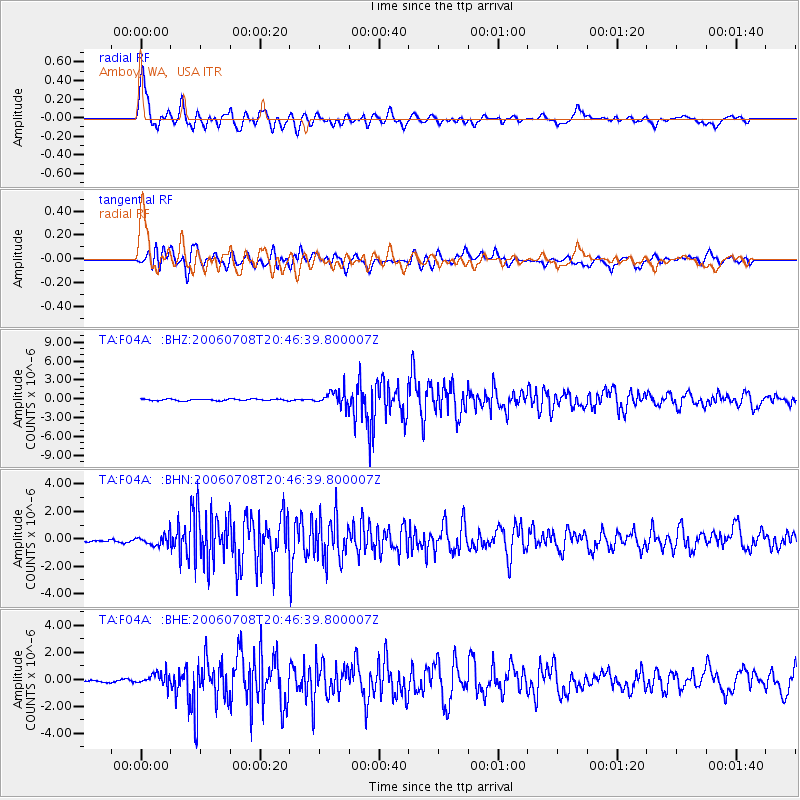
Signal To Noise
| Channel | StoN | STA | LTA |
| TA:F04A: :BHN:20060708T20:46:39.800007Z | 2.9197562 | 3.818455E-7 | 1.3077992E-7 |
| TA:F04A: :BHE:20060708T20:46:39.800007Z | 3.7208998 | 4.675314E-7 | 1.256501E-7 |
| TA:F04A: :BHZ:20060708T20:46:39.800007Z | 8.71693 | 1.1593655E-6 | 1.3300159E-7 |
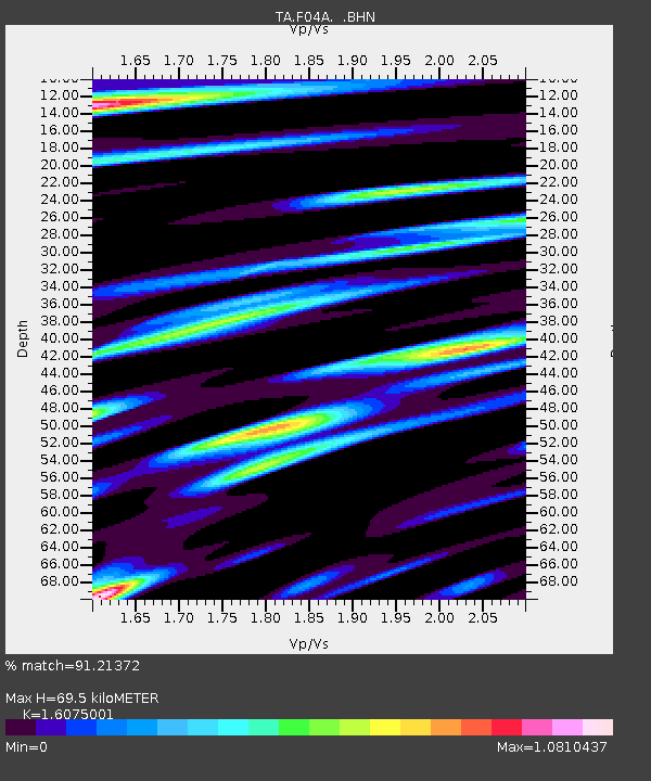
| Arrivals | |
| Ps | 7.0 SECOND |
| PpPs | 25 SECOND |
| PsPs/PpSs | 32 SECOND |

