You are here: Home > Network List > CI - Caltech Regional Seismic Network Stations List
> Station DAN Danby, California, USA > Earthquake Result Viewer
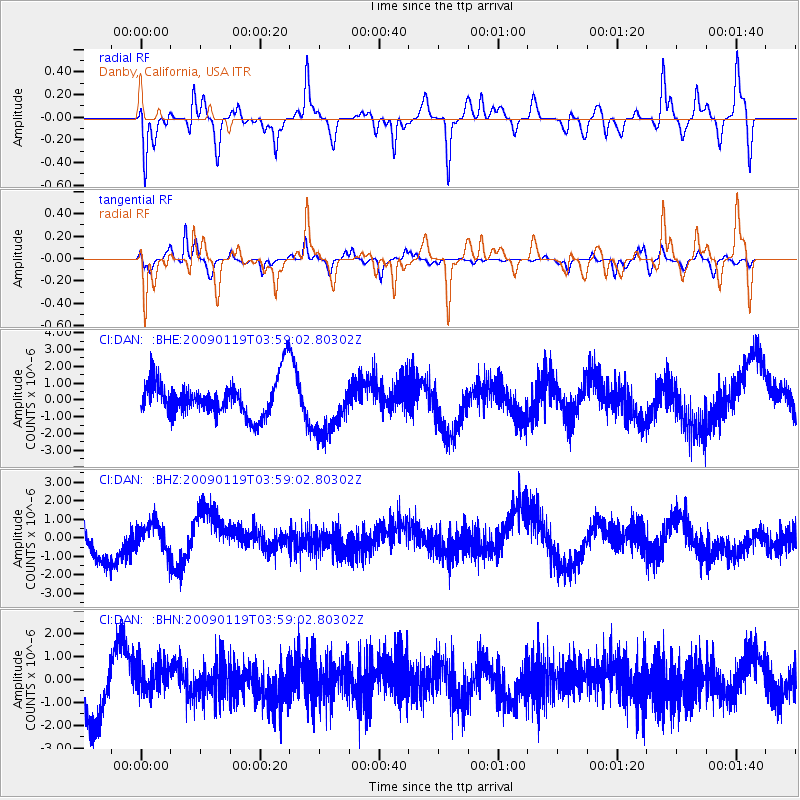
DAN Danby, California, USA - Earthquake Result Viewer
*The percent match for this event was below the threshold and hence no stack was calculated.
| Earthquake location: |
Southeast Of Loyalty Islands |
| Earthquake latitude/longitude: |
-22.5/170.8 |
| Earthquake time(UTC): |
2009/01/19 (019) 03:46:37 GMT |
| Earthquake Depth: |
35 km |
| Earthquake Magnitude: |
6.0 MW, 5.3 MB |
| Earthquake Catalog/Contributor: |
WHDF/NEIC |
|
| Network: |
CI Caltech Regional Seismic Network |
| Station: |
DAN Danby, California, USA |
| Lat/Lon: |
34.64 N/115.38 W |
| Elevation: |
398 m |
|
| Distance: |
90.1 deg |
| Az: |
52.36 deg |
| Baz: |
242.657 deg |
| Ray Param: |
$rayparam |
*The percent match for this event was below the threshold and hence was not used in the summary stack. |
|
| Radial Match: |
66.566376 % |
| Radial Bump: |
397 |
| Transverse Match: |
47.14801 % |
| Transverse Bump: |
378 |
| SOD ConfigId: |
2658 |
| Insert Time: |
2010-02-26 01:05:37.195 +0000 |
| GWidth: |
2.5 |
| Max Bumps: |
400 |
| Tol: |
0.001 |
|
Signal To Noise
| Channel | StoN | STA | LTA |
| CI:DAN: :BHZ:20090119T03:59:02.80302Z | 1.0001407 | 7.5828746E-7 | 7.581808E-7 |
| CI:DAN: :BHN:20090119T03:59:02.80302Z | 0.85937023 | 7.4364965E-7 | 8.653426E-7 |
| CI:DAN: :BHE:20090119T03:59:02.80302Z | 1.5556334 | 1.7102391E-6 | 1.0993843E-6 |
| Arrivals |
| Ps | |
| PpPs | |
| PsPs/PpSs | |


