You are here: Home > Network List > TA - USArray Transportable Network (new EarthScope stations) Stations List
> Station F04A Amboy, WA, USA > Earthquake Result Viewer
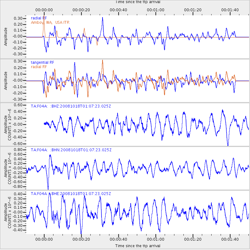
F04A Amboy, WA, USA - Earthquake Result Viewer
*The percent match for this event was below the threshold and hence no stack was calculated.
| Earthquake location: |
Eastern New Guinea Reg., P.N.G. |
| Earthquake latitude/longitude: |
-7.0/147.3 |
| Earthquake time(UTC): |
2008/10/18 (292) 00:54:39 GMT |
| Earthquake Depth: |
77 km |
| Earthquake Magnitude: |
5.8 MB, 5.7 MW, 5.7 MW |
| Earthquake Catalog/Contributor: |
WHDF/NEIC |
|
| Network: |
TA USArray Transportable Network (new EarthScope stations) |
| Station: |
F04A Amboy, WA, USA |
| Lat/Lon: |
45.93 N/122.42 W |
| Elevation: |
211 m |
|
| Distance: |
95.2 deg |
| Az: |
44.486 deg |
| Baz: |
265.391 deg |
| Ray Param: |
$rayparam |
*The percent match for this event was below the threshold and hence was not used in the summary stack. |
|
| Radial Match: |
55.040924 % |
| Radial Bump: |
400 |
| Transverse Match: |
45.276012 % |
| Transverse Bump: |
400 |
| SOD ConfigId: |
2560 |
| Insert Time: |
2010-03-05 22:41:25.693 +0000 |
| GWidth: |
2.5 |
| Max Bumps: |
400 |
| Tol: |
0.001 |
|
Signal To Noise
| Channel | StoN | STA | LTA |
| TA:F04A: :BHN:20081018T01:07:23.025Z | 2.365168 | 3.79492E-7 | 1.6045033E-7 |
| TA:F04A: :BHE:20081018T01:07:23.025Z | 1.7441202 | 2.346548E-7 | 1.345405E-7 |
| TA:F04A: :BHZ:20081018T01:07:23.025Z | 0.73995656 | 9.704044E-8 | 1.3114342E-7 |
| Arrivals |
| Ps | |
| PpPs | |
| PsPs/PpSs | |


