You are here: Home > Network List > TA - USArray Transportable Network (new EarthScope stations) Stations List
> Station F04A Amboy, WA, USA > Earthquake Result Viewer
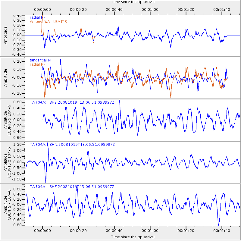
F04A Amboy, WA, USA - Earthquake Result Viewer
*The percent match for this event was below the threshold and hence no stack was calculated.
| Earthquake location: |
Tonga Islands |
| Earthquake latitude/longitude: |
-22.0/-173.7 |
| Earthquake time(UTC): |
2008/10/19 (293) 12:55:05 GMT |
| Earthquake Depth: |
35 km |
| Earthquake Magnitude: |
5.7 MB, 5.3 MS, 5.6 MW, 5.5 MW |
| Earthquake Catalog/Contributor: |
WHDF/NEIC |
|
| Network: |
TA USArray Transportable Network (new EarthScope stations) |
| Station: |
F04A Amboy, WA, USA |
| Lat/Lon: |
45.93 N/122.42 W |
| Elevation: |
211 m |
|
| Distance: |
82.0 deg |
| Az: |
33.357 deg |
| Baz: |
226.996 deg |
| Ray Param: |
$rayparam |
*The percent match for this event was below the threshold and hence was not used in the summary stack. |
|
| Radial Match: |
66.883644 % |
| Radial Bump: |
400 |
| Transverse Match: |
52.066696 % |
| Transverse Bump: |
375 |
| SOD ConfigId: |
2560 |
| Insert Time: |
2010-03-05 22:41:28.176 +0000 |
| GWidth: |
2.5 |
| Max Bumps: |
400 |
| Tol: |
0.001 |
|
Signal To Noise
| Channel | StoN | STA | LTA |
| TA:F04A: :BHN:20081019T13:06:51.098997Z | 2.7619302 | 7.641221E-7 | 2.7666235E-7 |
| TA:F04A: :BHE:20081019T13:06:51.098997Z | 0.70323944 | 1.5208914E-7 | 2.1626934E-7 |
| TA:F04A: :BHZ:20081019T13:06:51.098997Z | 1.1042578 | 2.663842E-7 | 2.4123372E-7 |
| Arrivals |
| Ps | |
| PpPs | |
| PsPs/PpSs | |


