You are here: Home > Network List > TA - USArray Transportable Network (new EarthScope stations) Stations List
> Station F04A Amboy, WA, USA > Earthquake Result Viewer
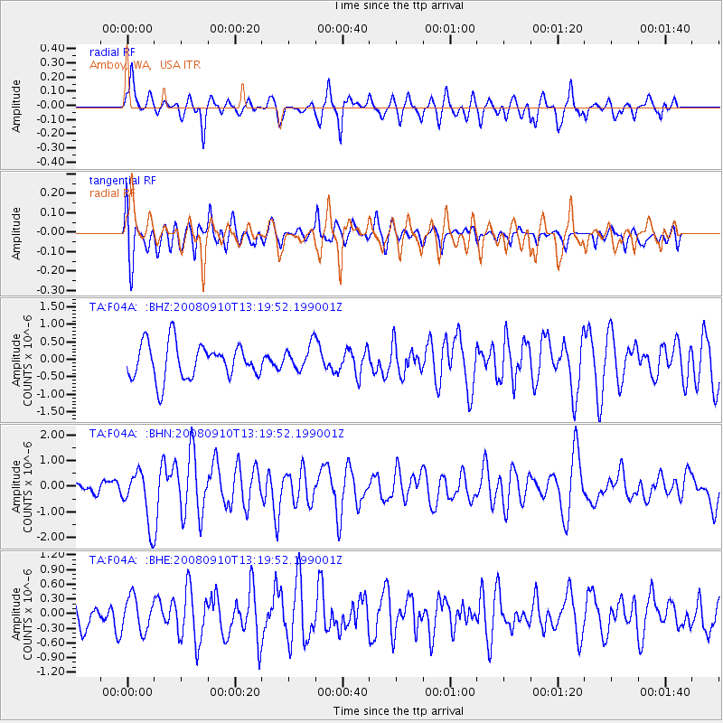
F04A Amboy, WA, USA - Earthquake Result Viewer
*The percent match for this event was below the threshold and hence no stack was calculated.
| Earthquake location: |
Central Mid-Atlantic Ridge |
| Earthquake latitude/longitude: |
8.1/-38.7 |
| Earthquake time(UTC): |
2008/09/10 (254) 13:08:14 GMT |
| Earthquake Depth: |
10 km |
| Earthquake Magnitude: |
6.3 MB, 6.5 MS, 6.6 MW, 6.6 MW |
| Earthquake Catalog/Contributor: |
WHDF/NEIC |
|
| Network: |
TA USArray Transportable Network (new EarthScope stations) |
| Station: |
F04A Amboy, WA, USA |
| Lat/Lon: |
45.93 N/122.42 W |
| Elevation: |
211 m |
|
| Distance: |
79.9 deg |
| Az: |
315.195 deg |
| Baz: |
88.848 deg |
| Ray Param: |
$rayparam |
*The percent match for this event was below the threshold and hence was not used in the summary stack. |
|
| Radial Match: |
53.53529 % |
| Radial Bump: |
400 |
| Transverse Match: |
62.70632 % |
| Transverse Bump: |
400 |
| SOD ConfigId: |
2504 |
| Insert Time: |
2010-03-05 22:41:29.793 +0000 |
| GWidth: |
2.5 |
| Max Bumps: |
400 |
| Tol: |
0.001 |
|
Signal To Noise
| Channel | StoN | STA | LTA |
| TA:F04A: :BHN:20080910T13:19:52.199001Z | 3.263484 | 1.0211639E-6 | 3.1290605E-7 |
| TA:F04A: :BHE:20080910T13:19:52.199001Z | 1.1535201 | 3.4153726E-7 | 2.9608262E-7 |
| TA:F04A: :BHZ:20080910T13:19:52.199001Z | 0.7273843 | 3.6395508E-7 | 5.0036147E-7 |
| Arrivals |
| Ps | |
| PpPs | |
| PsPs/PpSs | |


