You are here: Home > Network List > TA - USArray Transportable Network (new EarthScope stations) Stations List
> Station F04A Amboy, WA, USA > Earthquake Result Viewer
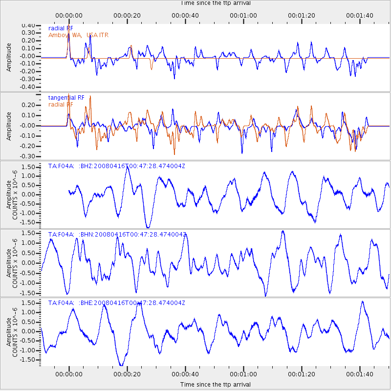
F04A Amboy, WA, USA - Earthquake Result Viewer
*The percent match for this event was below the threshold and hence no stack was calculated.
| Earthquake location: |
Tonga Islands |
| Earthquake latitude/longitude: |
-18.6/-175.7 |
| Earthquake time(UTC): |
2008/04/16 (107) 00:35:48 GMT |
| Earthquake Depth: |
10 km |
| Earthquake Magnitude: |
5.6 MB, 6.3 MS, 6.3 MW, 6.3 MW |
| Earthquake Catalog/Contributor: |
WHDF/NEIC |
|
| Network: |
TA USArray Transportable Network (new EarthScope stations) |
| Station: |
F04A Amboy, WA, USA |
| Lat/Lon: |
45.93 N/122.42 W |
| Elevation: |
211 m |
|
| Distance: |
80.3 deg |
| Az: |
34.579 deg |
| Baz: |
230.463 deg |
| Ray Param: |
$rayparam |
*The percent match for this event was below the threshold and hence was not used in the summary stack. |
|
| Radial Match: |
69.61491 % |
| Radial Bump: |
400 |
| Transverse Match: |
57.454037 % |
| Transverse Bump: |
370 |
| SOD ConfigId: |
2504 |
| Insert Time: |
2010-03-05 22:41:32.310 +0000 |
| GWidth: |
2.5 |
| Max Bumps: |
400 |
| Tol: |
0.001 |
|
Signal To Noise
| Channel | StoN | STA | LTA |
| TA:F04A: :BHN:20080416T00:47:28.474004Z | 0.9220497 | 9.747289E-7 | 1.0571326E-6 |
| TA:F04A: :BHE:20080416T00:47:28.474004Z | 1.9791312 | 7.813022E-7 | 3.947703E-7 |
| TA:F04A: :BHZ:20080416T00:47:28.474004Z | 1.095155 | 6.3740487E-7 | 5.820225E-7 |
| Arrivals |
| Ps | |
| PpPs | |
| PsPs/PpSs | |


