You are here: Home > Network List > TA - USArray Transportable Network (new EarthScope stations) Stations List
> Station F04A Amboy, WA, USA > Earthquake Result Viewer
F04A Amboy, WA, USA - Earthquake Result Viewer
*The percent match for this event was below the threshold and hence no stack was calculated.
| Earthquake location: |
Near Coast Of Guatemala |
| Earthquake latitude/longitude: |
13.6/-90.6 |
| Earthquake time(UTC): |
2008/04/15 (106) 03:03:04 GMT |
| Earthquake Depth: |
33 km |
| Earthquake Magnitude: |
5.6 MB, 5.8 MS, 6.1 MW, 6.1 MW |
| Earthquake Catalog/Contributor: |
WHDF/NEIC |
|
| Network: |
TA USArray Transportable Network (new EarthScope stations) |
| Station: |
F04A Amboy, WA, USA |
| Lat/Lon: |
45.93 N/122.42 W |
| Elevation: |
211 m |
|
| Distance: |
42.0 deg |
| Az: |
326.609 deg |
| Baz: |
129.928 deg |
| Ray Param: |
$rayparam |
*The percent match for this event was below the threshold and hence was not used in the summary stack. |
|
| Radial Match: |
58.623352 % |
| Radial Bump: |
400 |
| Transverse Match: |
45.8201 % |
| Transverse Bump: |
400 |
| SOD ConfigId: |
2504 |
| Insert Time: |
2010-03-05 22:41:39.252 +0000 |
| GWidth: |
2.5 |
| Max Bumps: |
400 |
| Tol: |
0.001 |
|
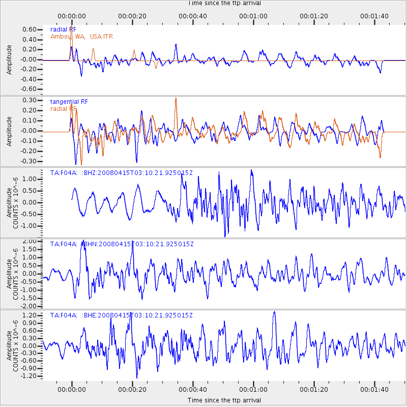
Signal To Noise
| Channel | StoN | STA | LTA |
| TA:F04A: :BHN:20080415T03:10:21.925015Z | 4.697873 | 1.125949E-6 | 2.3967206E-7 |
| TA:F04A: :BHE:20080415T03:10:21.925015Z | 1.0641142 | 3.0957477E-7 | 2.9092251E-7 |
| TA:F04A: :BHZ:20080415T03:10:21.925015Z | 0.94432575 | 3.4911022E-7 | 3.696926E-7 |
| Arrivals |
| Ps | |
| PpPs | |
| PsPs/PpSs | |


