You are here: Home > Network List > TA - USArray Transportable Network (new EarthScope stations) Stations List
> Station F04A Amboy, WA, USA > Earthquake Result Viewer
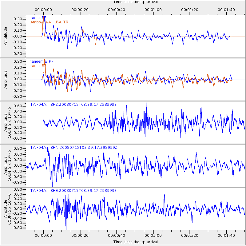
F04A Amboy, WA, USA - Earthquake Result Viewer
*The percent match for this event was below the threshold and hence no stack was calculated.
| Earthquake location: |
Dodecanese Islands, Greece |
| Earthquake latitude/longitude: |
35.8/27.9 |
| Earthquake time(UTC): |
2008/07/15 (197) 03:26:34 GMT |
| Earthquake Depth: |
52 km |
| Earthquake Magnitude: |
6.5 MB, 6.4 MW, 6.4 MW |
| Earthquake Catalog/Contributor: |
WHDF/NEIC |
|
| Network: |
TA USArray Transportable Network (new EarthScope stations) |
| Station: |
F04A Amboy, WA, USA |
| Lat/Lon: |
45.93 N/122.42 W |
| Elevation: |
211 m |
|
| Distance: |
94.3 deg |
| Az: |
339.696 deg |
| Baz: |
23.84 deg |
| Ray Param: |
$rayparam |
*The percent match for this event was below the threshold and hence was not used in the summary stack. |
|
| Radial Match: |
55.726364 % |
| Radial Bump: |
400 |
| Transverse Match: |
63.774666 % |
| Transverse Bump: |
400 |
| SOD ConfigId: |
2504 |
| Insert Time: |
2010-03-05 22:41:49.592 +0000 |
| GWidth: |
2.5 |
| Max Bumps: |
400 |
| Tol: |
0.001 |
|
Signal To Noise
| Channel | StoN | STA | LTA |
| TA:F04A: :BHN:20080715T03:39:17.298999Z | 4.193322 | 4.87427E-7 | 1.1623885E-7 |
| TA:F04A: :BHE:20080715T03:39:17.298999Z | 2.3321283 | 2.3323955E-7 | 1.00011455E-7 |
| TA:F04A: :BHZ:20080715T03:39:17.298999Z | 0.9800985 | 1.03670175E-7 | 1.05775264E-7 |
| Arrivals |
| Ps | |
| PpPs | |
| PsPs/PpSs | |


