You are here: Home > Network List > TA - USArray Transportable Network (new EarthScope stations) Stations List
> Station F04A Amboy, WA, USA > Earthquake Result Viewer
F04A Amboy, WA, USA - Earthquake Result Viewer
*The percent match for this event was below the threshold and hence no stack was calculated.
| Earthquake location: |
Kuril Islands |
| Earthquake latitude/longitude: |
49.9/156.4 |
| Earthquake time(UTC): |
2008/08/04 (217) 04:42:14 GMT |
| Earthquake Depth: |
77 km |
| Earthquake Magnitude: |
5.6 MB, 5.8 MW, 5.7 MW |
| Earthquake Catalog/Contributor: |
WHDF/NEIC |
|
| Network: |
TA USArray Transportable Network (new EarthScope stations) |
| Station: |
F04A Amboy, WA, USA |
| Lat/Lon: |
45.93 N/122.42 W |
| Elevation: |
211 m |
|
| Distance: |
52.0 deg |
| Az: |
61.007 deg |
| Baz: |
305.783 deg |
| Ray Param: |
$rayparam |
*The percent match for this event was below the threshold and hence was not used in the summary stack. |
|
| Radial Match: |
66.305244 % |
| Radial Bump: |
400 |
| Transverse Match: |
59.89626 % |
| Transverse Bump: |
400 |
| SOD ConfigId: |
2504 |
| Insert Time: |
2010-03-05 22:41:53.051 +0000 |
| GWidth: |
2.5 |
| Max Bumps: |
400 |
| Tol: |
0.001 |
|
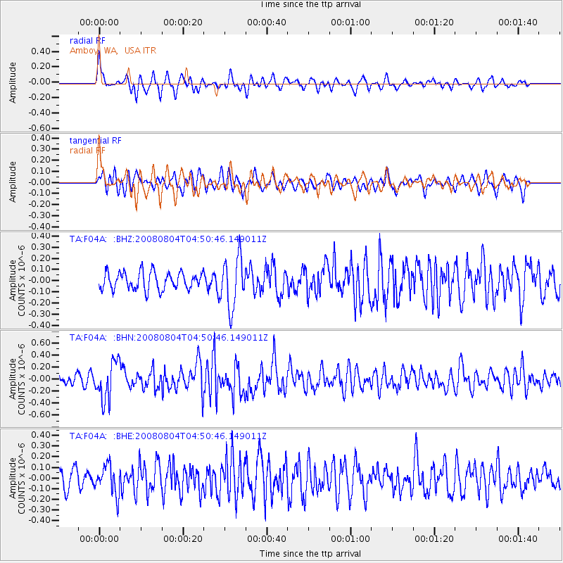
Signal To Noise
| Channel | StoN | STA | LTA |
| TA:F04A: :BHN:20080804T04:50:46.149011Z | 3.3575644 | 3.260325E-7 | 9.710387E-8 |
| TA:F04A: :BHE:20080804T04:50:46.149011Z | 1.4378769 | 1.3742239E-7 | 9.557313E-8 |
| TA:F04A: :BHZ:20080804T04:50:46.149011Z | 2.9403024 | 2.2870465E-7 | 7.77827E-8 |
| Arrivals |
| Ps | |
| PpPs | |
| PsPs/PpSs | |


