You are here: Home > Network List > TA - USArray Transportable Network (new EarthScope stations) Stations List
> Station F04A Amboy, WA, USA > Earthquake Result Viewer
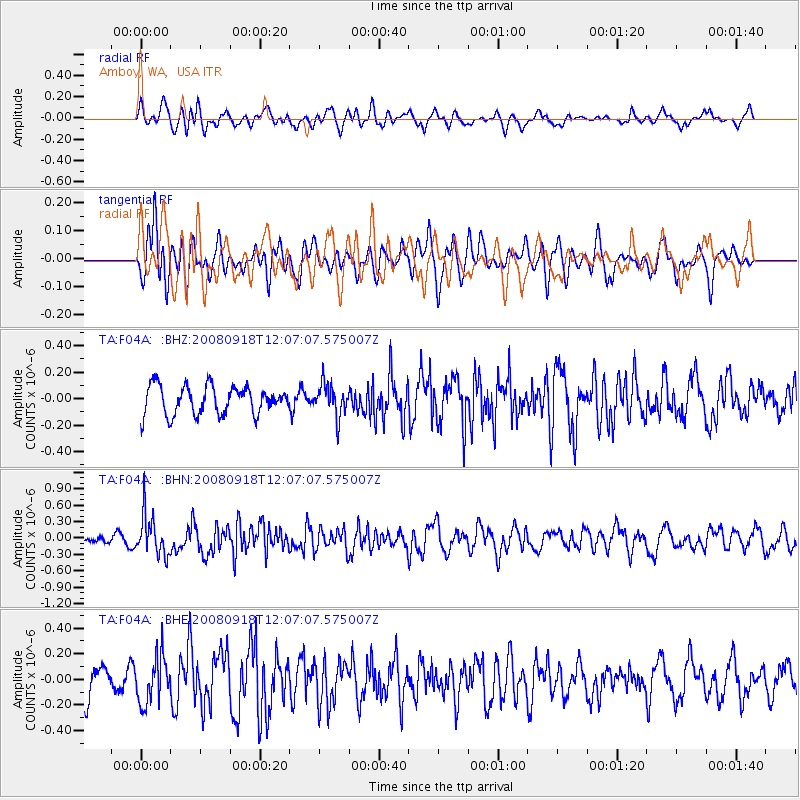
F04A Amboy, WA, USA - Earthquake Result Viewer
*The percent match for this event was below the threshold and hence no stack was calculated.
| Earthquake location: |
Near East Coast Of Kamchatka |
| Earthquake latitude/longitude: |
51.9/158.4 |
| Earthquake time(UTC): |
2008/09/18 (262) 11:58:50 GMT |
| Earthquake Depth: |
67 km |
| Earthquake Magnitude: |
5.7 MB, 5.9 MW, 5.8 MW |
| Earthquake Catalog/Contributor: |
WHDF/NEIC |
|
| Network: |
TA USArray Transportable Network (new EarthScope stations) |
| Station: |
F04A Amboy, WA, USA |
| Lat/Lon: |
45.93 N/122.42 W |
| Elevation: |
211 m |
|
| Distance: |
50.0 deg |
| Az: |
63.565 deg |
| Baz: |
307.381 deg |
| Ray Param: |
$rayparam |
*The percent match for this event was below the threshold and hence was not used in the summary stack. |
|
| Radial Match: |
54.834335 % |
| Radial Bump: |
400 |
| Transverse Match: |
41.90571 % |
| Transverse Bump: |
400 |
| SOD ConfigId: |
2504 |
| Insert Time: |
2010-03-05 22:42:06.004 +0000 |
| GWidth: |
2.5 |
| Max Bumps: |
400 |
| Tol: |
0.001 |
|
Signal To Noise
| Channel | StoN | STA | LTA |
| TA:F04A: :BHN:20080918T12:07:07.575007Z | 3.2857184 | 3.680981E-7 | 1.12029724E-7 |
| TA:F04A: :BHE:20080918T12:07:07.575007Z | 1.7047795 | 1.8300294E-7 | 1.07346985E-7 |
| TA:F04A: :BHZ:20080918T12:07:07.575007Z | 1.1170179 | 1.1937773E-7 | 1.0687181E-7 |
| Arrivals |
| Ps | |
| PpPs | |
| PsPs/PpSs | |


