You are here: Home > Network List > TA - USArray Transportable Network (new EarthScope stations) Stations List
> Station F04A Amboy, WA, USA > Earthquake Result Viewer
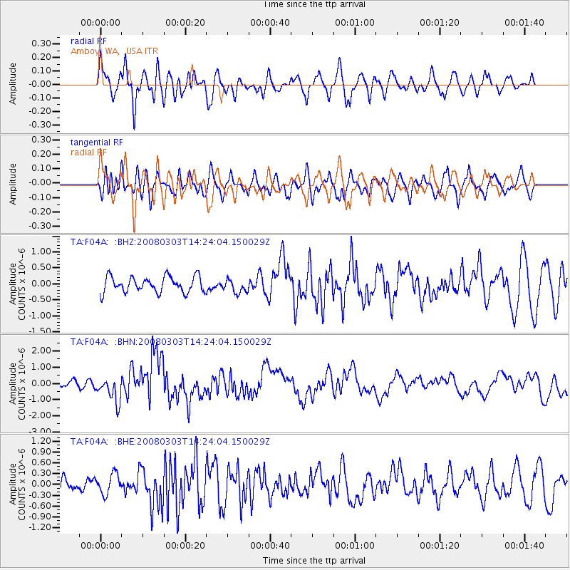
F04A Amboy, WA, USA - Earthquake Result Viewer
*The percent match for this event was below the threshold and hence no stack was calculated.
| Earthquake location: |
Philippine Islands Region |
| Earthquake latitude/longitude: |
13.4/125.6 |
| Earthquake time(UTC): |
2008/03/03 (063) 14:11:14 GMT |
| Earthquake Depth: |
24 km |
| Earthquake Magnitude: |
6.4 MB, 6.9 MW, 6.8 MW |
| Earthquake Catalog/Contributor: |
WHDF/NEIC |
|
| Network: |
TA USArray Transportable Network (new EarthScope stations) |
| Station: |
F04A Amboy, WA, USA |
| Lat/Lon: |
45.93 N/122.42 W |
| Elevation: |
211 m |
|
| Distance: |
95.1 deg |
| Az: |
40.537 deg |
| Baz: |
294.987 deg |
| Ray Param: |
$rayparam |
*The percent match for this event was below the threshold and hence was not used in the summary stack. |
|
| Radial Match: |
65.76117 % |
| Radial Bump: |
400 |
| Transverse Match: |
71.73943 % |
| Transverse Bump: |
400 |
| SOD ConfigId: |
2504 |
| Insert Time: |
2010-03-05 22:42:07.521 +0000 |
| GWidth: |
2.5 |
| Max Bumps: |
400 |
| Tol: |
0.001 |
|
Signal To Noise
| Channel | StoN | STA | LTA |
| TA:F04A: :BHN:20080303T14:24:04.150029Z | 4.2907925 | 8.0337406E-7 | 1.872321E-7 |
| TA:F04A: :BHE:20080303T14:24:04.150029Z | 1.2046975 | 2.8297E-7 | 2.3488884E-7 |
| TA:F04A: :BHZ:20080303T14:24:04.150029Z | 0.88442963 | 2.1637119E-7 | 2.446449E-7 |
| Arrivals |
| Ps | |
| PpPs | |
| PsPs/PpSs | |


