You are here: Home > Network List > TA - USArray Transportable Network (new EarthScope stations) Stations List
> Station F04A Amboy, WA, USA > Earthquake Result Viewer
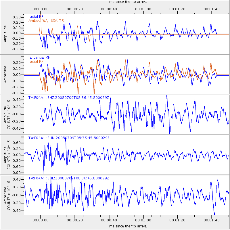
F04A Amboy, WA, USA - Earthquake Result Viewer
*The percent match for this event was below the threshold and hence no stack was calculated.
| Earthquake location: |
Loyalty Islands |
| Earthquake latitude/longitude: |
-20.9/168.8 |
| Earthquake time(UTC): |
2008/07/09 (191) 08:24:16 GMT |
| Earthquake Depth: |
39 km |
| Earthquake Magnitude: |
5.6 MB, 4.9 MS, 5.4 MW |
| Earthquake Catalog/Contributor: |
WHDF/NEIC |
|
| Network: |
TA USArray Transportable Network (new EarthScope stations) |
| Station: |
F04A Amboy, WA, USA |
| Lat/Lon: |
45.93 N/122.42 W |
| Elevation: |
211 m |
|
| Distance: |
91.1 deg |
| Az: |
40.605 deg |
| Baz: |
240.672 deg |
| Ray Param: |
$rayparam |
*The percent match for this event was below the threshold and hence was not used in the summary stack. |
|
| Radial Match: |
67.429474 % |
| Radial Bump: |
400 |
| Transverse Match: |
66.67564 % |
| Transverse Bump: |
400 |
| SOD ConfigId: |
2504 |
| Insert Time: |
2010-03-05 22:42:28.049 +0000 |
| GWidth: |
2.5 |
| Max Bumps: |
400 |
| Tol: |
0.001 |
|
Signal To Noise
| Channel | StoN | STA | LTA |
| TA:F04A: :BHN:20080709T08:36:45.800029Z | 2.70349 | 3.5118453E-7 | 1.2990043E-7 |
| TA:F04A: :BHE:20080709T08:36:45.800029Z | 1.2559732 | 1.4191252E-7 | 1.12990094E-7 |
| TA:F04A: :BHZ:20080709T08:36:45.800029Z | 0.9670264 | 1.3451185E-7 | 1.3909843E-7 |
| Arrivals |
| Ps | |
| PpPs | |
| PsPs/PpSs | |


