You are here: Home > Network List > GS - US Geological Survey Networks Stations List
> Station KAN11 Stewart Ranch, Harper County, KS, USA > Earthquake Result Viewer
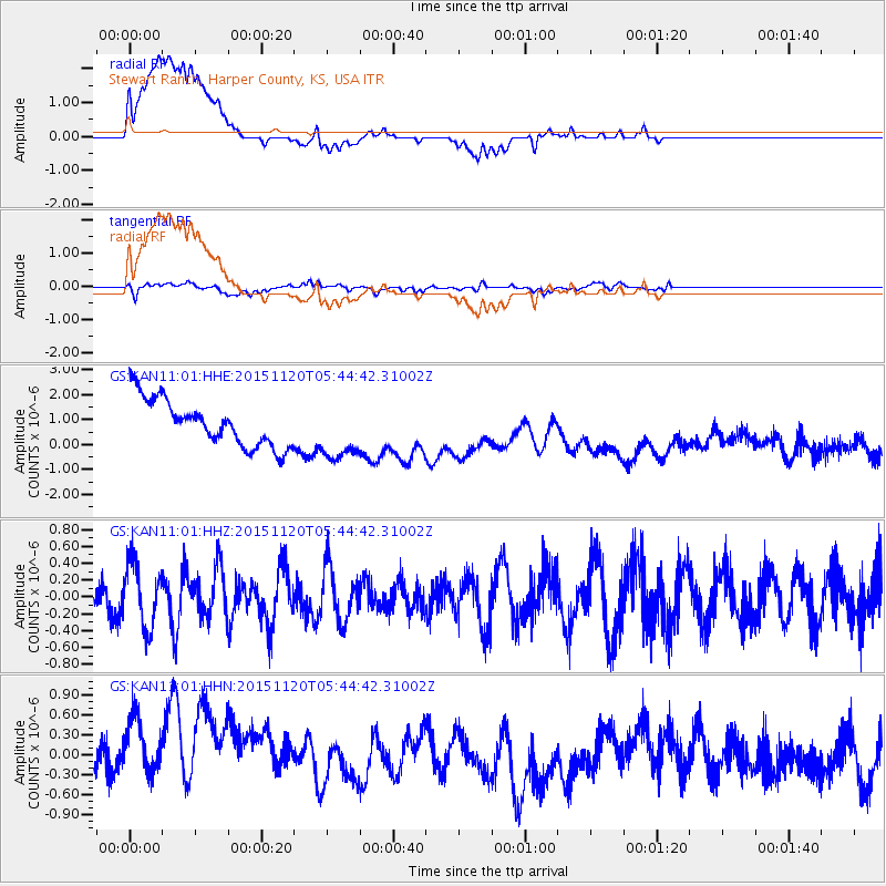
KAN11 Stewart Ranch, Harper County, KS, USA - Earthquake Result Viewer
*The percent match for this event was below the threshold and hence no stack was calculated.
| Earthquake location: |
Bonin Islands, Japan Region |
| Earthquake latitude/longitude: |
26.4/142.7 |
| Earthquake time(UTC): |
2015/11/20 (324) 05:31:52 GMT |
| Earthquake Depth: |
13 km |
| Earthquake Magnitude: |
5.5 MB |
| Earthquake Catalog/Contributor: |
NEIC PDE/NEIC COMCAT |
|
| Network: |
GS US Geological Survey Networks |
| Station: |
KAN11 Stewart Ranch, Harper County, KS, USA |
| Lat/Lon: |
37.21 N/97.91 W |
| Elevation: |
410 m |
|
| Distance: |
94.9 deg |
| Az: |
44.288 deg |
| Baz: |
308.323 deg |
| Ray Param: |
$rayparam |
*The percent match for this event was below the threshold and hence was not used in the summary stack. |
|
| Radial Match: |
40.19382 % |
| Radial Bump: |
400 |
| Transverse Match: |
67.32263 % |
| Transverse Bump: |
400 |
| SOD ConfigId: |
1259291 |
| Insert Time: |
2015-12-04 06:24:53.462 +0000 |
| GWidth: |
2.5 |
| Max Bumps: |
400 |
| Tol: |
0.001 |
|
Signal To Noise
| Channel | StoN | STA | LTA |
| GS:KAN11:01:HHZ:20151120T05:44:42.31002Z | 1.080506 | 3.7690722E-7 | 3.4882476E-7 |
| GS:KAN11:01:HHN:20151120T05:44:42.31002Z | 1.1462989 | 9.447678E-7 | 8.241897E-7 |
| GS:KAN11:01:HHE:20151120T05:44:42.31002Z | 1.284483 | 1.1933615E-6 | 9.2905987E-7 |
| Arrivals |
| Ps | |
| PpPs | |
| PsPs/PpSs | |


